
Kilve to Lilstock Walk: A Beautiful Somerset Coastline

Updated: Aug 28
Kilve to Lilstock: A Somerset Coast Walk
There are stretches of the Somerset coast that remain surprisingly little known, and the walk from Kilve to Lilstock is one of them. Starting at Kilve Beach, the route follows the clifftops eastwards along a wonderfully rugged section of the Bristol Channel coast, with the Quantock Hills rising behind you and Blue Anchor Bay opening out to the west.
It is an easy walk in terms of distance and terrain, but there is plenty to make you stop along the way. Kilve is famous for its extraordinary geology and fossil-rich foreshore, while the cliffs and shoreline around Lilstock reveal a fascinating story of ancient seas, industry and a harbour that has long since disappeared.
For me, this is one of those Somerset walks where the landscape becomes more interesting the longer you look at it. There is geology beneath your feet, history in the cliffs and, on a clear day, an enormous sweep of coast and sea ahead.
Getting to the Start of the Hike at Kilve Village

Getting to Kilve Beach
To begin the walk, make your way to the village of Kilve on the northern slopes of the Quantock Hills. The village lies just off the A39 between Bridgwater and Minehead. Turn towards the coast and follow the lane down towards Kilve Beach, passing the ancient Chantry ruins on the way.
The road becomes narrower and rather bumpy as it approaches the coast, eventually reaching the small parking area near Kilve Pill and the beach. This is a useful place to start the walk because you can head directly down to the shore before joining the coastal path.
Kilve is a popular starting point for exploring this section of the Somerset coast, particularly because of its remarkable geology. If you are planning to spend time looking at the rocks and fossils as well as walking, it is worth allowing considerably longer than the basic walking distance suggests.
The walk itself is straightforward, with the route heading east from Kilve towards Lilstock. My original route description gives the return distance as around three-and-a-half miles if you retrace your steps, or about five miles if you make the inland return via Kilton. The going is generally very easy.

Kilve Beach and Its Remarkable Fossils
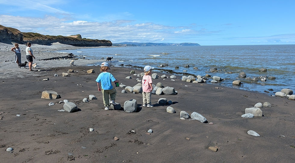
Before setting off towards Lilstock, it is worth spending some time on Kilve Beach because this is no ordinary stretch of Somerset shoreline. The cliffs and foreshore expose layers of Lower Jurassic Blue Lias – alternating bands of limestone, mudstone and dark shale laid down roughly 200 million years ago when this part of Britain was covered by a shallow sea.
At low tide the limestone forms broad, almost paved platforms across the foreshore, while the darker shales between them can contain fossils. Ammonites are among the most obvious finds, and the geology of the Kilve–Lilstock coastline is internationally important to geologists because of the remarkably complete sequence of Lower Jurassic rocks exposed here.
There is another intriguing chapter to the story. Some of the dark shale contains a high proportion of organic material and is oil-bearing. In the early twentieth century there was even an attempt to extract oil from the local shale, leaving behind the brick remains of an oil retort near the beach. It is an extraordinary thought that the same rocks which now attract walkers, fossil hunters and geologists were once regarded as a potential source of industrial fuel.
The fossils are tempting, but this is a place where I think looking is more rewarding than hammering. The Somerset geology guide specifically notes that fossils can be difficult to extract and recommends leaving them where they are. The real pleasure is seeing the layers of ancient seabed spread out beneath your feet and realising just how much geological history is exposed along this apparently quiet piece of coast.

Clifftop Views and Royal Navy Observation Post
From Kilve, follow the clifftop path eastwards, enjoying the breathtaking views of the northern Quantock and Blue Anchor Bay. Look out for the Range Quadrant Hut, a white-painted structure on the edge of the cliffs where Royal Navy observers watch military exercises.
Check out our post on 6 Great Somerset Walks
Uncovering the Haunting History of Lilstock
Further along the path, you'll reach Lilstock, a location steeped in history and mystery. Once home to a bustling harbour and hotel, Lilstock now offers only haunting remnants of its past. As you return to Kilve, you can either follow the same coastal path or take an inland route past Kilton, which offers a different perspective on this stunning area.
Fact File
Basic Hike: from Kilve Beach, on the West Somerset coast, east along the clifftop path to Lilstock - and then back, either via the same route or over the hill past Kilton.
Recommended map: Ordnance Survey Explorer 140 - Quantock Hills.
Distance and going: three-and-a-half - or five miles depending on return route. Very easy going.
How long is the Kilve to Lilstock walk?
The walk from Kilve Beach to Lilstock and back is around 3½ miles using the coastal route, or about 5 miles if you return inland via Kilton.
Is the Kilve to Lilstock walk difficult?
It is generally an easy walk, although coastal conditions and uneven ground around the beach can make things more challenging.
Can you find fossils at Kilve Beach?
Yes. Kilve is particularly well known for its Blue Lias geology and fossils, making the beach one of the most interesting geological locations on the Somerset coast.
Where does the Kilve to Lilstock walk start?
The walk begins near Kilve Beach, reached through Kilve village from the A39 between Bridgwater and Minehead.
Is Kilve on the South West Coast Path?
Yes. The walk follows the coastal route along this section of the Somerset coast.


