
The Cornish Coast: Hidden Coves, Dramatic Cliffs and Timeless Fishing Villages

Updated: Jul 7
Why the Cornish Coast Is So Special
Few coastlines stir the soul quite like Cornwall's. From towering granite cliffs and tiny fishing harbours to hidden coves where seals bask beneath Atlantic skies, this remarkable peninsula has shaped my life as a journalist, walker and novelist. Over more than five decades I've wandered hundreds of miles of the Cornish coast, uncovering places that never appear in most guidebooks. This article brings together some of the landscapes, stories and unforgettable moments that make Cornwall one of Britain's greatest coastal destinations.
To see more of our Cornish Walks click here


Here’s a walk article which includes Bedruthan that I wrote many years ago…
There was a jangling of keys and in an instance I spotted the beast I’d driven miles to see. Corn buntings are not immediately obvious in the great ornithological pantheon of birds. They look like fat sparrows.
Moreover, they are – in West Country terms – an endangered species. The modest bunting has only one toehold left on Cornwall and that is on the particularly lovely strip of coastline that stretches from Padstow down towards Newquay.
I was only too pleased to go and meet the farmers who are being paid by the RSPB to farm in a way that helps the corn buntings, as one of them happens to own and run my one of favourite campsites.

And while I was there, Ordnance Survey's Explorer Map 106 persuaded me there was a decent chance of a circular stroll in the area that would enable me to breathe fresh air and spot small brown birds all at the same time.
The big golden sand beach at Porthcothan stretches inland with all the wide self-importance of a great river in its final lap of estuarine glory. Except there is no river, just the trickles and runlets of an extremely modest stream.
Up at the top of the beach this stream makes a bit of a fuss with a puddle or two, but across the road its true riverine identity is revealed. The great sandy gut that promised a river of force was made by a minnow so small that the Ordnance Survey doesn't even bother to give it a name on the map.
What they do show though is a footpath which follows the stream's northern bank. To find it you must climb a short way up the hill that leads towards Padstow and there you'll see a track on your right.
Once past Porthcothan Mill the path resumes its stream-side course all the way up to the hamlet of Penrose. I have never been to Ireland, but I'm blowed if Penrose doesn't have an Irish feel to it. I somehow expected a local sage to issue from one of the squat cottages and lilt lyrical as a jig.
But not a soul stirred in the lonely corner that somehow ended up in Cornwall instead of Connemara and so I took the road due south back down into the river valley and up the other side towards Trethewell.
Just after bridging the stream, the lane does a left and then a right and at the latter corner a footpath heads across the field towards the coast. This cuts a dog-leg and rejoins the road at Trevorgey. Directly opposite another lane climbs gently to Engollan where yet another branches right to Tregona.
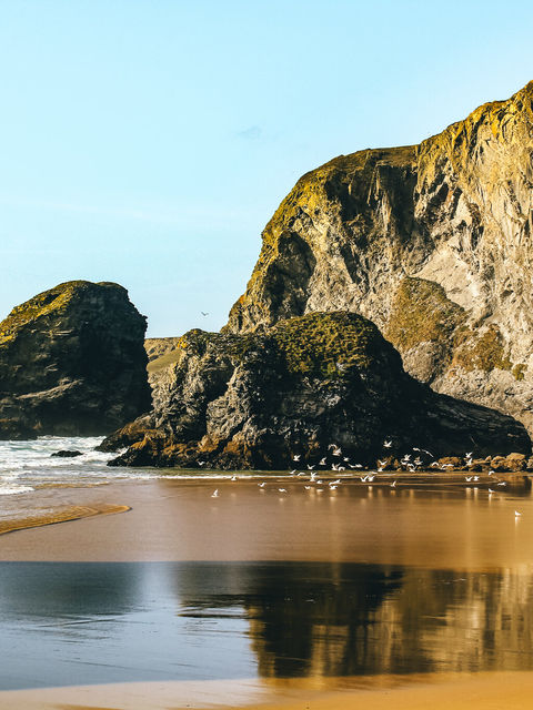
Here you have a choice of following it past Bedruthan to the busy coastal road or turning right down the valley along a footpath which eventually terminates on the B3276 further north at a place called Efflins. The former route will take you close the Bedruthan Steps which is quite simply one of the most fabulous beaches to be found anywhere in Europe.
The National Trust owns much of the cliff-top property here and the organisation has a car park and visitor information centre. But I was there recently and the August crowds were very much at large, so I took the latter option of the shorter, latter route past Efflins to Pentire Farm.
This corner of coast is also owned by the National Trust and here the organisation has a hostel where volunteer workers can stay.
"I have just three wardens covering 40 per cent of a 100 mile long stretch of coastline," I was informed by the local Countryside Manager of the trust's extensive North Cornish holdings. "So we very much rely on volunteers - some of whom come on organised full-time work parties, while others are just interested in doing a day or two here or there. The Beach Head Hostel is where they can stay."
I had telephoned to ask him the name of the curious plant which seems to dominate so many of the cliff-top hedgerows around this particular part of the world. Having walked around dramatic Park Head and descended down to a bay called Porth Mear I had wondered, as I have often done before, about this strange feathery shrub that sits upon all the dry stone walls near Trevendar Farm.
"Tamarisk," he said immediately. "It comes from South Africa originally and you often find it around parts of the Mediterranean coast. The point is that it is tremendously salt resistant so it makes an excellent windbreak near the sea.
"By-the-way, when you were down there in the valley behind Porth Mear did you notice that we've been doing quite a lot of work up in the reed beds by the stream? That valley really is a marvellous habitat for wildlife but it does need looking after..."
I had noticed. This peaceful, silent coombe is one of my favourite places in Cornwall and often have I seen a peregrine quartering its secret crooks and crannies.
There is something almost Spanish about the valley's northern flanks - the dry stone walls and the ancient tracks audibly escorted by the soughing of the gently bending tamarisk. This is where I spotted my corn bunting, which is easy to identify when you know that it’s call sounds exactly like the jangling of keys.
Back at the campsite Chateau Hesp was flapping splendidly in the wind and pinned to it there was a note from my wife and kids that said: “Gone to the beach...” Which, apart from walking, is what you go to Cornwall for.
Fact File
Basic Hike: from Porthcothan Cove inland to Penrose and back via Bedruthan Steps and the coast.
Recommended map: Ordnance Survey Explorer 106.
Distance & Going: 7 miles easy going.

I've been walking, photographing and writing about Cornwall for more than half a century. During that time I've covered thousands of miles of coastline, interviewed fishermen, lighthouse keepers, artists, lifeboat crews and chefs, and discovered countless places that continue to surprise me. This article is a celebration of the coastline that has inspired so much of my journalism and fiction.

FAQ
Where is the most beautiful part of the Cornish coast?
Beauty is subjective, but favourites include the Land's End peninsula, the Lizard, the Helford River, St Agnes Heritage Coast, Boscastle and the north coast around Tintagel. Cornwall offers everything from rugged Atlantic cliffs to sheltered fishing harbours.
When is the best time to visit the Cornish coast?
Late spring and early autumn are often ideal, with fewer crowds, mild weather and excellent walking conditions.
What is the best coastal walk in Cornwall?
The South West Coast Path offers hundreds of miles of outstanding walking. Popular sections include St Ives to Zennor, Boscastle to Tintagel, Porthcurno to Land's End and Fowey to Polruan.
Is the Cornish coast good for wildlife?
Yes. Visitors regularly see grey seals, dolphins, basking sharks, peregrine falcons, choughs and a wealth of seabirds depending on the season.
Which fishing villages should I visit?
Some of the most atmospheric include Mousehole, Port Isaac, Cadgwith, Polperro, Boscastle, Coverack and Newlyn, each with its own distinctive character and maritime history.


