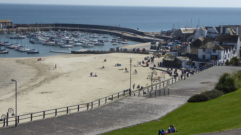
6 Classic West Dorset Walks: Coastal Ridges, Literary Haunts & Village Pubs

Updated: Aug 2

West Dorset provides an entirely different walking environment than anywhere I can think of further west—and Chesil Beach is quite different from anywhere else in the world. From the steep-sided hill-forts guarding the Marshwood Vale to hidden dry valleys behind Lulworth, this corner of the world has a landscape formula born in heaven.
Here are six of my favourite circular routes across West Dorset, cut down from my newspaper archives, complete with practical route details and a proper local pub near each public footpath.
🏨 Staying in West Dorset?
Planning to explore several of these walks? West Dorset makes an excellent base for a two- or three-night break, with charming inns, seaside hotels, cosy B&Bs and holiday cottages close to the Jurassic Coast.

1. Abbotsbury, Linton Hill & St Catherine’s Chapel
The sun was shining, the sea was sparkling—so there was only one thing for it while staying in West Dorset, and that was to walk, walk, walk.

Abbotsbury is one of those picture-postcard places tucked right under a steep limestone ridge at the western end of Chesil Bank. Every ancient house is built of wonderful honey-coloured stone, and almost every building is thatched—it is Dorset’s Dunster.
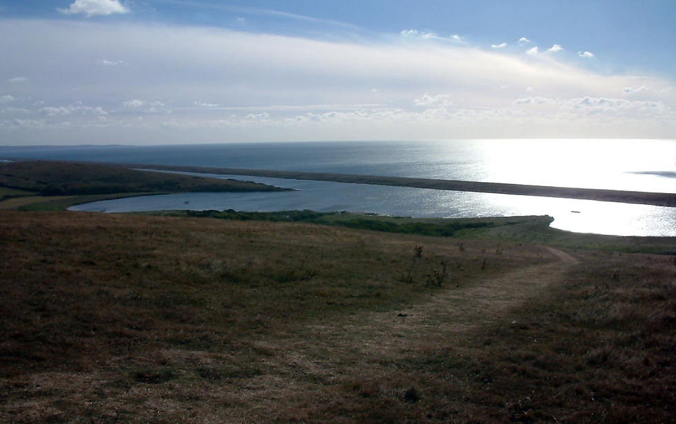
Setting out from the village car park near the ancient abbey, I headed south towards the famous Swannery before joining the quiet lane past Nunnery Grove. From here, the coast path climbs the western spur of Linton Hill—a magnificent spot to take in Dorset’s coastal ridges, including the distant Hardy Monument looming 237 metres above sea level.
After passing Clayhanger Farm, the lane leads back towards the village with spectacular views of St Catherine’s Chapel perched on its strange stepped hill. It is a seaside version of Glastonbury Tor. Climbing to the summit gives you sweeping views across the entire eight-mile shingle expanse of The Fleet lagoon.
YOU MIGHT ALSO ENJOY ANOTHER OF OUR WALKS COLLECTIONS - CLICK HERE
Fact File
Distance & Going: 3.5 miles; easy to moderate with one short, steep hill climb.
Start / Parking: Abbotsbury Abbey car park (DT3 4JJ).
Route Summary: Village car park → Swannery lane → Linton Hill → Clayhanger Farm → St Catherine's Hill summit → Village return.
Recommended Local Pub
The Ilchester Arms (Market Street, Abbotsbury, DT3 4JR) A classic 16th-century stone coaching inn right in the heart of the village. Perfect for untying your boots and enjoying a pint of local Dorset ale after tackling the ridge.

2. Lambert’s Castle & Coney’s Castle Circuit
There are many reasons for taking a walk, but one particularly satisfying excuse is to go in search of a literary connection. My poet pal James Crowden invited me up to Lambert’s Castle Hill after I’d mentioned reawakening a fascination for Geoffrey Household’s classic 1930s thriller, Rogue Male.

The high green ridges above the Marshwood Vale served as Household's inspiration for where his hero goes to ground. Starting at the National Trust car park on the B3165, we set off on a figure-of-eight hike taking in both Lambert’s Castle and Coney’s Castle.
Around 2,500 years ago, these iron-age hill-forts formed a fierce frontier zone between the Durotriges people to the east and the Dumnonii to the west. Today, the level clockwise walk around the Lambert's Castle plateau offers some of the easiest hill-walking in the region—following a broad track that served as an old horse racecourse for the historic Lambert Hill Fair.

Dropping down the south-eastern tip of the ridge, a quiet lane leads across to Coney’s Castle, where ancient ramparts look down the valley towards the English Channel at Charmouth. We looped back around the lower contours via the hamlet of Fishponds before climbing back to the car park.
Fact File
Distance & Going: 3.5 miles; easy top-walking with one steep descent and climb between the forts.
Start / Parking: National Trust Lambert's Castle Car Park, B3165 (DT6 5RB).
Route Summary: Lambert’s Castle plateau → South-east ridge descent → Coney’s Castle lane → Fishponds hamlet → Lambert’s Castle ascent.
Recommended Local Pub
The Bottle Inn (Marshwood, DT6 5QJ) Situated just down the ridge in Marshwood village, this historic 16th-century thatched pub—famous for hosting the World Nettle Eating Championship—remains a proper, welcoming village local.

3. Charmouth, Ridge Water & Chardown Hill
A visit to Charmouth is a constant reminder of just how dynamic the ever-changing Jurassic Coast really is. In its heyday 195 million years ago, visitors here would have been ordering ammonites by the dozen. Today, the shale cliffs still regularly hurl evidence of ancient history down onto the shingle.
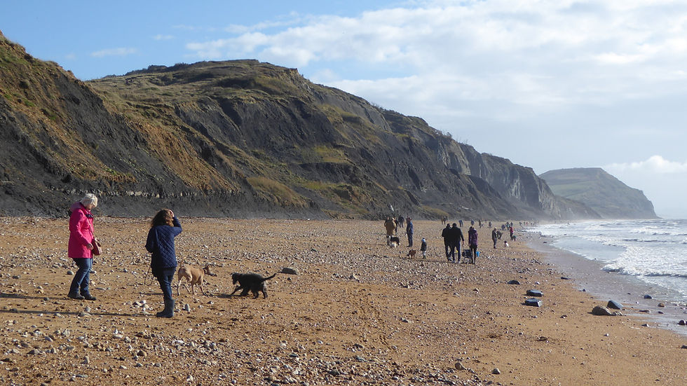
I set out from the beach by ascending towards Cain’s Folly, the scene of a massive historic landslide where full-grown trees now populate a secret undercliff. The coast path here wanders close to the edge, dipping down into the lush coombes of Westhay and Ridge Water—where National Trust eco-friendly farming allows wild grasses and wildflowers to thrive.
After crossing Ridge Water, I climbed over Broom Cliff, passed Upcott, and took the steep path to the summit of Chardown Hill. Standing three metres higher than the famed Golden Cap nearby, Chardown offers unmatched vistas across Lyme Bay. The return route traverses Stonebarrow Hill westwards before descending Stonebarrow Lane back into Charmouth.
SEE OTHER SOUTH WEST COAST PATH WALKS HERE

Fact File
Distance & Going: 5 miles; moderate to strenuous with sharp coastal valley ascents.
Start / Parking: Charmouth Foreshore Car Park (DT6 6LS).
Route Summary: Charmouth seafront → Cain’s Folly → Westhay Coombe → Ridge Water → Chardown Hill → Stonebarrow Hill → Charmouth village.
Recommended Local Pub
The Royal Standard (The Seafront, Charmouth, DT6 6LN) Positioned right by the shingle at the foot of lower Charmouth, this traditional free house is the place for a post-hike pint of local cask ale right by the sea.
Making a weekend of it?
These walks are all within easy reach of one another, making them ideal for a long weekend on Dorset's Jurassic Coast.

4. Thomas Hardy’s Cottage & Thorncombe Wood
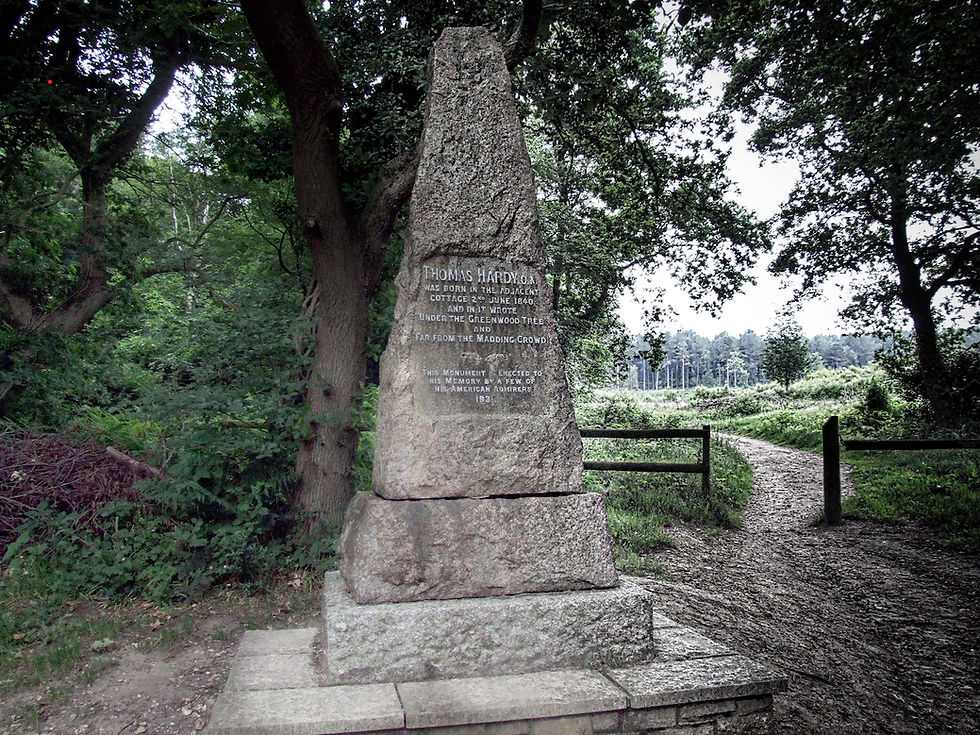
When a romantic fellow is young and moody, he may love a little Thomas Hardy sprinkled among his walks amid southern downs. Standing in the tiny bedroom at Higher Bockhampton where Hardy was born in 1840, you instantly feel the soft burden of rustic history.

This stroll through ancient woodlands and heaths soaks up the world once so beloved by the great writer. Starting near Higher Bockhampton—the village Hardy called Upper Mellstock in his novels—you trail half a mile through the bluebells of Thorncombe Wood down to the poet's old thatched cottage.
Leaving the cottage, the trail heads east into the dense pine and heather clearings of what was once Hardy’s wild "untameable" Egdon Heath. Skirting the tranquil waters of Rushy Pond—featured in The Withered Arm—the circular path loops back through the beech arcades of Thorncombe Wood.
Fact File
Distance & Going: 3 miles; easy, gentle walking along soft forest tracks and woodland paths.
Start / Parking: Thorncombe Wood Visitor Centre Car Park, Higher Bockhampton (DT2 8XB).
Route Summary: Visitor Centre → Thorncombe Wood → Hardy’s Cottage → Egdon Heath trails → Rushy Pond → Circular return.
Recommended Local Pub
The Wise Man Inn (West Stafford, DT2 8FI) Located just two miles south in West Stafford (Hardy’s "Mellstock" parish area), this country pub is renowned for its outstanding food, open fires, and great local cask ales.
ENJOYR SOME OF OUR CORNISH WALKS HERE
5. Shaftesbury, Gold Hill & The Two Vales
Shaftesbury reminds me more of a hilltop burg in France or Spain than almost anywhere else in England. Perched high on a steep greensand escarpment above two wider vales, it boasts a broad, handsome promenade running right along the southern cliff edge.

My old friend, the poet Catherine Simmonds, took me on a circuit that shows off the very best of this Anglo-Saxon hilltop town. We began by descending footpaths down the steep northern slopes to the village of Enmore Green, before circling the base of the plateau along quiet lanes to St James.
From St James, we tackled the steep cobbles of Gold Hill—made famous worldwide by Ridley Scott’s iconic 1970s Hovis advertisement. After passing the massive stone bastions of historic Shaftesbury Abbey, we finished with a stroll along Park Walk, taking in the vast panoramas stretching across the Blackmore Vale.

Fact File
Distance & Going: 2.5 miles; easy distance, but includes one very steep cobbled incline.
Start / Parking: Bell Street Car Park, Shaftesbury (SP7 8JR).
Route Summary: Town Centre → Enmore Green descent → St James village → Gold Hill climb → Abbey wall → Park Walk promenade.
Recommended Local Pub
The Mitre (High Street, Shaftesbury, SP7 8JE) Situated right near the head of Gold Hill, The Mitre features a dramatic multi-level sun terrace offering breathtaking panoramic views straight out across the vale.

6. Lulworth Cove, Durdle Door & Scratchy Bottom
The section of coast path between Lulworth Cove and Durdle Door gets crowded on the sunniest days, but striking off inland reveals empty, rolling chalk countryside that feels a million miles away from the seaside crowds.

Starting at West Lulworth, this route avoids the main cliff climb by heading inland past Hambury Farm, walking up the quiet grassy valley behind Hambury Tout. Not a soul did I see until reaching the watershed, where the path plunges down into a large, riverless chalk amphitheatre known delightfully as Scratchy Bottom.
At the sea end of the valley, the path joins the South West Coast Path. Turning east brings you past the iconic limestone arch of Durdle Door. A climb over the 440-foot crest of Hambury Tout rewards you with views of the Lulworth military ranges to the east and Portland Bill to the west, before descending past Stair Hole into the blue waters of Lulworth Cove.

Fact File
Distance & Going: 3.5 miles; moderate with a few sustained chalk-downland climbs.
Start / Parking: Lulworth Cove Visitor Centre Car Park (BH20 5RS).
Route Summary: Lulworth Cove car park → Hambury Farm → Scratchy Bottom valley → Coast Path east → Durdle Door → Hambury Tout → Stair Hole → Lulworth Cove.
Recommended Local Pub
The Castle Inn (Main Street, West Lulworth, BH20 5UQ) A beautifully restored 16th-century thatched pub located just up the street from the cove. It offers a great selection of real ales, cider, and fresh local Dorset seafood away from the immediate beach crowds.
TAKE A LOOK AT OUR SOMERSET WALKS PAGE HERE

Planning Your Dorset Walking Holiday
Whether you're looking for a country inn, a coastal hotel or a self-catering cottage, you'll find plenty of excellent places to stay within easy reach of these six walks.
Frequently Asked Questions (FAQ)
What is the best time of year to walk in West Dorset?
Spring and autumn are ideal. Spring brings bluebells to Thorncombe Wood and blooming wildflowers along the coastal coombes, while clear autumn days offer crisp, panoramic views across the Marshwood Vale and Chesil Beach without the summer heat or heavy holiday crowds.
Are these West Dorset walking routes dog-friendly?
Yes, all six routes follow public rights of way and established coastal trails suitable for dogs. However, please keep dogs on leads near livestock—especially around the chalk downlands near Lulworth and the sheep grazing on Lambert's Castle—and be mindful of steep cliff edges along the South West Coast Path.
What is the toughest walk on this list?
The Charmouth to Chardown Hill circular is the most physically demanding due to the steep coastal valley ascents and sharp climbs over Broom Cliff. For an easier, level stroll with minimum gradient, opt for the top loop around Lambert’s Castle or the woodland paths surrounding Thomas Hardy’s Cottage.
Can I complete these walks using public transport?
While rural Dorset is easiest to navigate by car, major trailheads like Shaftesbury, Charmouth, and Lulworth Cove have regular regional bus connections from main hubs like Weymouth, Dorchester, and Axminster.
Why avoid walking directly along Chesil Beach?
Walking on the small-grained shingle of Chesil Bank is extremely tiring on the legs, and because the eight-mile Fleet Lagoon separates the beach from the mainland, there are no exit points. Dips onto the cliff paths and inland ridges—such as the Abbotsbury to Linton Hill route—offer the best views of Chesil Beach without the grueling shingle trudge.