
Six Great Pub Walks in Devon

Devon is a land of endless variety. While we often celebrate its dramatic sea-cliffs, hidden coves, and sweeping river valleys, there are times when it’s thoroughly refreshing to discover something new, distinct, and unexpected.
Whether you are seeking the salty air of open dune-lands, a cool retreat into a shadowy river gorge, or a high-ridge march across ancient heathland, nothing completes a West Country walk quite like a welcoming pub at the end.
Here are six outstanding Devon pub walks—condensed from my travels across the county—designed to show off the very best of our landscape and local hospitality.
IF YOU ENJOY THIS POST CHECK OUT OUR OTHER DEVON WALKS HERE
1. Appledore Circular & Northam Burrows
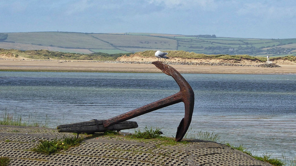
Appledore… what a lovely name, and what a fine place perched on the banks of the River Torridge where it meets the Taw before making a grand entrance into Bideford Bay. Turning our backs on gentle river valleys and rolling forests, Northam Burrows offers something novel: a magical dune-land jutting into the bay. The peninsula is reminiscent of Holland or Texel off the coast of Friesland—a big flat piece of sandy jetsam anchored on the Devon coast.
Starting from Appledore's historic harbour, a twenty-minute stroll around the peninsula brings you to the Country Park. Crossing the spiky Sharp Rush and the shingle ridge leads down onto the sweeping three-kilometre sandy beach extending from Westward Ho! (the only place name boasting an exclamation mark). Out towards Zulu Sands, gulls gather where razor-shell beds thrive, while sheep and ponies—grazed by local 'potwallopers' holding ancient common rights—mooch contentedly alongside the South West Coast Path.
Heading back along the river shore, you pass The Skern, a quiet salt-marsh creek famed for its wading birds and rare winged visitors. From there, it is only a matter of minutes back into the heart of Appledore for well-earned coastal refreshment.

Fact File
Start/Finish: Appledore Harbour / Northam Burrows Country Park
Distance & Terrain: 4.5 miles; flat terrain across pavements, grassy tracks, and sandy/shingle beach.
Recommended Map: OS Explorer 139 (Bideford, Ilfracombe & Barnstaple)
Featured Pub: The Beaver Inn, Irsha Street, Appledore, EX39 1RY
Pub Details: A historic, dog-friendly maritime pub situated right on the Torridge estuary edge. Renowned for fresh local seafood, real ales, and an outdoor terrace with sweeping water views. Open daily for food and drinks.
Website: www.beaverinn.co.uk

2. Branscombe to Beer Circular
The coombe leading down to the shore at Branscombe Mouth is bathed in glorious light where sea meets sky. Ascending from the beach brings you past an agreeable, scattered caravan site into the Undercliff—Devon’s very own jungle zone, where a mother-cliff plunges into the sea and creates a sheltered, contorted natural amphitheatre.
In decades past, this frost-free haven hosted celebrated cliffside agriculture. Fishermen-farmers tilled steep plots known as 'plats', fertilising early broad beans, strawberries, and famous Branscombe spuds with sea-kelp hauled up by donkeys. Today, the warm, micro-climatic Undercliff thrives with wildlife; peregrine falcons soar overhead while Speckled Wood butterflies flutter through the sunny glades.
Ascending towards Beer Head brings you onto the high chalk plateau above gleaming white cliffs. The path curls down into one of the most charming cove villages in the South West. After sampling fresh local crab by the beach in Beer, an inland public right of way leads back across the high downs directly to Branscombe.

Fact File
Start/Finish: Branscombe Mouth
Distance & Terrain: 4 miles; moderate going with coastal ascents and undulating Undercliff paths.
Recommended Map: OS Explorer 115 & 116 (Exeter & Sidmouth / Lyme Regis)
Featured Pub: The Anchor Inn, Fore Street, Beer, EX12 3ET
Pub Details: A classic, characterful cliffside inn overlooking Beer’s shingle beach and fishing boats. Serves regional real ales and locally caught seafood, featuring a cliff-top beer garden with stunning sea views. Open daily year-round.
Website: www.anchorinnbeer.co.uk
3. Bigbury, Ringmore & Ayrmer Cove Circular
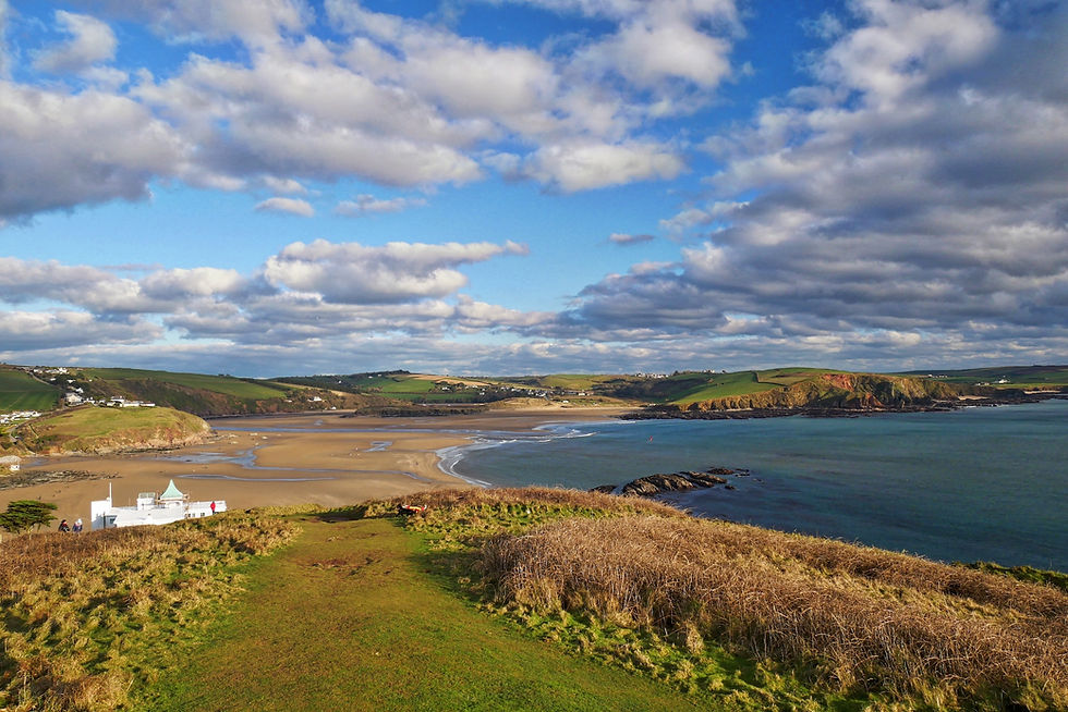
No visit to Bigbury-on-Sea is complete without eyeing Burgh Island, lurking 270 yards offshore. Reachable on foot at low tide or via the famous sea-tractor, this historic isle was home to pilchard fishers, ancient monasteries, and legendary smugglers. Using those illicit maritime links as our guide, this walk strikes west around Warren Point along the South West Coast Path into Challaborough Bay before heading inland.
Climbing above Black Stone brings you to an inland path heading toward Ringmore—a stretch known locally as 'Reptile Alley' for its sunbathing lizards and adders. Ringmore itself is a quintessential thatched village anchored by a historic pub rich in smuggling lore. From the village, an antediluvian leafy byway—the old smugglers' track—winds down into picturesque Ayrmer Cove, a secluded jewel framed by high, rugged cliffs where ancient galleons once wrecked.
After exploring the quiet strand, a short, steep climb to Toby's Point reveals panoramic vistas across the whole of Bigbury Bay before returning you along the coastal path.

Fact File
Start/Finish: Bigbury-on-Sea Car Park
Distance & Terrain: 3.4 miles; moderate with a couple of short, steep climbs.
Recommended Map: OS Explorer 102 (Brixham & Dartmouth)
Featured Pub: Journey's End Inn, Ringmore, TQ7 4HL
Pub Details: A gorgeous 13th-century thatched pub hidden in the valley at Ringmore. Full of historic character, flagstone floors, and log fires, offering fine cask ales and top-quality seasonal dishes. Open daily for lunch and evening service.
Website: www.thejourneysendinn.co.uk

4. Wellington Monument to Culmstock Beacon
The Blackdown Hills Area of Outstanding Natural Beauty represents one of the most unspoilt inland landscapes in the Westcountry. This high-ridge walk explores an extraordinary flat-topped escarpment that reaches out like a giant diving board into the green patchwork of mid-Devon.
Starting near Crossways Farm, an ancient ridgeway tracks through Forestry Commission woodlands onto Blackdown Common—a wild, heather-clad heath that feels like a preserved piece of ancient England. Striking south-west along the escarpment reveals sweeping, multi-county panoramas before arriving at Culmstock Beacon. Here stands what is believed to be the only surviving 16th-century stone beacon house in England, built to signal the approach of the Spanish Armada.
Descending the steep slope past Pitt Farm brings you into the verdant valley below. Crossing the gentle River Culm, the path tracks alongside water meadows into Culmstock—an idyllic village anchored by its ancient church and an outstanding riverside pub.

Fact File
Start/Finish: Crossways Farm / Culmstock Village
Distance & Terrain: 5 miles (linear); easy ridgeway walking followed by one steep descent and riverside paths.
Recommended Map: OS Explorer 128 (Taunton & Blackdown Hills)
Featured Pub: The Culm Valley Inn, Woodgate Road, Culmstock, EX15 3JH
Pub Details: A celebrated, quirky riverside free house bursting with charm and local atmosphere. Famous for its exceptional pub food, generous cold platters, board specials, and excellent local ales. Positioned right beside the River Culm. Open daily.
Website: www.culmvalleyinn.co.uk
5.

Southern Circular
This circular hike delivers some of the most dramatic and savage coastal landscape in the British Isles. Starting from the Rocket House high above Hartland Quay—once home to brave rocket-rescuer squads who saved sailors from windward shipwrecks—the route descends past the historic quay buildings and museum nestled beneath towering dark cliffs.
Heading south along the coast path, you climb above Screda Point before reaching the strange, flat-bottomed amphitheatre surrounding St Catherine’s Tor. This miniature half-mountain is wrapped in legend, said to have hosted hermitages for both St Catherine and Celtic Saint Nectan, as well as ancient Roman activity. Beyond, contorted grey slate cliffs—twisted by geological forces into sharp, pointed arches—lead to Speke’s Mill Mouth, where a mountain stream plunges over the cliff edge in dramatic waterfalls.
Turning inland up the wooded valley leads to Milford and onwards to Stoke. Here, the 14th-century St Nectan’s Church boasts Devon’s second-tallest tower. A quiet path through neighbouring fields returns you directly to the Rocket House overlooking the Atlantic surge.

Fact File
Start/Finish: Hartland Quay Rocket House Car Park
Distance & Terrain: 4.2 miles; rugged and strenuous in places with steep coastal ascents.
Recommended Map: OS Explorer 126 (Clovelly & Hartland)
Featured Pub: The Wreckers Retreat (Hartland Quay Hotel), Hartland EX39 6DU
Pub Details: Perched right on the granite edge of the Atlantic Ocean, this uniquely atmospheric bar is packed with nautical memorabilia and shipwreck relics. Serves hearty pub food, local beers, and stunning sunset views over the breaking waves. Open daily year-round.
Website: www.hartlandquayhotel.co.uk
6. Fingle Bridge & The Teign Gorge
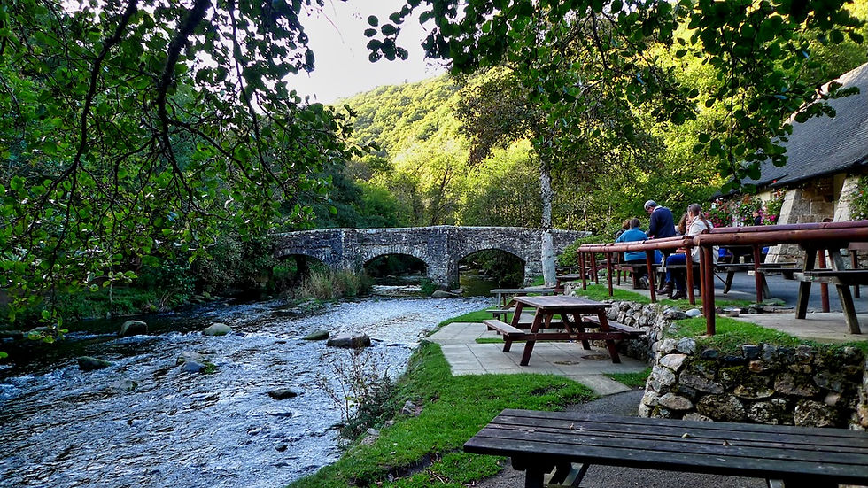
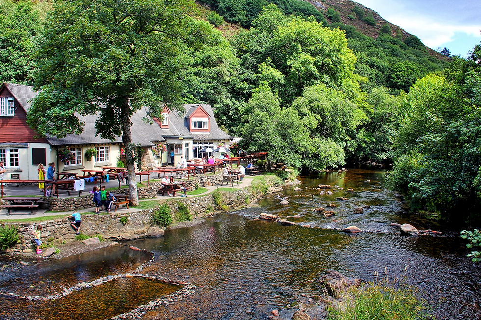
When summer heat hits, there is no finer retreat than the shadowy depth of the Teign Gorge. Hidden below Dartmoor’s high eastern fringes, this dramatic defile traps the icy freshness of the moorland river, creating a cool, sheltered sanctuary of oak woods and rushing water.
YOU CAN SEE MORE DARTMOOR WALKS HERE
Starting at the medieval stone arches of Fingle Bridge, cross to the southern bank and follow the riverside track upstream through Hannicombe and Whiddon Woods. Passing the historic turbine house—which generated hydro-electricity for Castle Drogo until 1994—a rustic footbridge leads across the foaming river. Pausing on the bridge offers views of the Teign roaring down over granite boulders and rocky slabs.
The return path follows the northern bank beneath the towering cliffs of Sharp Tor and Hunters Tor. National Trust steps guide you around rocky buttresses where the roar of white water echoes through the trees, eventually delivering you straight back to the idyllic riverside inn at Fingle Bridge.
Fact File
Start/Finish: Fingle Bridge, Drewsteignton
Distance & Terrain: 3 miles; easy to moderate riverside loop with well-defined paths and occasional rocky steps.
Recommended Map: OS Explorer OL28 (Dartmoor)
Featured Pub: Fingle Bridge Inn, Drewsteignton, Exeter, EX6 6QU
Pub Details: Nestled right on the banks of the River Teign at the base of the gorge. Features a large riverside beer garden under the trees, cozy indoor fires, real ales, and classic pub fare. A beloved haven for walkers, dogs, and families. Open daily.
Website: www.finglebridgeinn.co.uk

Frequently Asked Questions: Walking & Real Ale in Devon
Why is Devon considered such a premier county for pub walks?
Devon combines thousands of miles of public rights of way—stretching across two national parks (Dartmoor and Exmoor) and two coasts—with a exceptionally rich pub culture. Across Devon's active CAMRA branches (including North Devon, Exeter & East Devon, and South Devon), the county boasts hundreds of traditional free houses and independent inns dedicated to maintaining proper cask-conditioned ales, local ciders, and regional hospitality right on the trail.
What should walkers look for in a great CAMRA-worthy country pub?
For beer enthusiasts and ramblers alike, a great West Country pub offers well-kept cask real ales served via traditional handpull (or straight from the gravity barrel), local real ciders, log fires in winter, and a warm welcome for mud-splattered boots and dogs. Look out for pubs listed in CAMRA’s Good Beer Guide or those flying the flag for local Devon breweries and microbreweries such as Otter, Dartmoor, Clearwater, and Hanlons.
Are these pub walks suitable year-round?
Yes, though each season brings a different charm. High coastal paths like Hartland Quay or the Blackdown ridge offer dramatic winter vistas, while sheltered spots like the Teign Gorge or Branscombe Undercliff provide cool sanctuary in the height of summer. While the featured pubs are open year-round, it is always wise to check individual pub opening times—particularly for weekday food service outside peak holiday months.
Do I need specialist hiking gear for these routes?
Most of these six walks follow well-trodden sections of the South West Coast Path, National Trust trails, or public rights of way. A good pair of sturdy walking shoes or boots, a waterproof jacket, and an Ordnance Survey map (or OS Maps app) are recommended. Routes with steep drops or slippery slate (such as Hartland Quay or the Undercliffs) require reasonable footwear, especially after heavy rain.


