
Brean Down Cycle Route: from Brean to Weston-super-Mare

Updated: Sep 4
Some people have an incurable curiosity when it comes to the landscape. For example, if they see an interesting or picturesque place from afar, they automatically think: “Right… One day I’ll go to that place and see what it’s all about.” This article relates to exactly that sort of journey.

But there was a reason why it took me so long to embark on the particular journey of discovery, even though I had several times found myself being attracted to an obscure corner of the Somerset coast.
Let’s give you the lay of the land. If you climb Brean Down, one of England’s most dramatic and enigmatic coastal headlands, you will be rewarded with vast sweeping panoramas of the Somerset Levels. Brean, Berrow, Burnham-on-Sea and the River Parrett are, after all, the places where the flat-lands meet the sea. But swing around in an anti-clockwise direction and your observations will come to the place where the Mendip Hills rise from the lowlands.
At over 300 feet in height, Brean Down is actually an extreme westerly part of that range of hills, albeit one that somehow got divorced from its motherland to the east. The reason for this separation is that the meandering River Axe, for some reason best known to itself, made the decision to cut between the main bulk of the hills and their seaborne offspring, thereby making Brean Down almost an island. Indeed, the range’s other westerly offspring, Steep Holm, really is a bona-fide isle located a few miles out to sea.

Brean Down Cycle Route
That gap between Brean Down and the inland hills features a winding estuary, complete with all manner of roadbeds and mudbanks as well as a diverse collection of boats scattered around various creeks, crooks and crannies. Bringing this salty world of flatness to an abrupt halt is a large cliff, upon which stands a ruined church.
When you first set on eyes on this horizontal-versus-vertical world, you think you really must set to explore the area containing what must be the least-known and least-visited of all the West Country’s estuaries. But that, in the old days, was a lot easier said than done. Because there were no roads or even public footpaths delving into this tidal hinterland. You still can’t drive a motor vehicle across it - but you can now walk or pedal a bicycle, thanks to the excellent Brean Down Cycle Way.
And therein lies this journey of discovery. One fine day last week I did exactly that and cycled the BDCW from end-to-end, and can report that it is a hugely enjoyable 16-mile experience. The cycleway is actually eight miles in length, but you’re bound to want to double-up and go there and back on a bicycle, and the way we did this was to park at Brean just under the mighty Down.
Our plan was to cycle out across the estuarine parts of the trail, crossing the River Axe at a place called Brean Sluice, before going on to discover the ancient village of Uphill (proud host to that enigmatic ruined church on top of a cliff) and proceeding north up to the pier at Weston-Super-Mare. We’d have lunch somewhere along the way, then double back to Brean so that we could achieve the one really challenging bit of the cycleway - i.e. the very steep climb up onto the ridge where the trail follows the old coastguard track right out to the end of the dramatic seaborne peninsula.

The plan worked a treat and, perhaps thanks to the fabulous weather, it was one of the best days-out I’ve had this year. There are, though, two little provisos… The first is if you do the BDCW our way and start at Brean itself, you might be mystified (as we were) that there is not a single sign or noticeboard that tells you about the trail. Indeed, when I asked at the National Trust information hut, the lady in command told us she’d never heard of such a cycleway.


The other proviso is that the most exciting bit of the trail is the traverse of mighty Brean Down.
A warning about cycling up Brean Down
The final climb onto Brean Down is extremely steep. I was using an electric mountain bike and even then it was a serious climb; many cyclists on ordinary bikes will probably prefer to dismount and push. The route information also advises cyclists to dismount on the private-road section near the National Trust café.
Perhaps one reason there’s no mention of the cycleway at Brean is because it’s the one bit of the BDCW that uses the county highway. You have to cycle back down Brean’s one and only access road (the one lined famously with caravan parks) to the junction near Warren Farm where a side-road heads off inland. That’s where you first notice the cycleway proper - it runs along the pavement before heading off across the flatlands at a place called Diamond Farm. And that is where you are introduced to the section of cycleway which makes the whole journey possible.

The website (https://greenwaysandcycleroutes.org/brean-down-way/) explains that an organisation called Greenways teamed up with North Somerset Council to “deliver this complex cross-border route via the tidal sluices across the River Axe owned by the Environment Agency… Greenways held two camps here to construct the critical three kilometre long central section and a 100-metre-long timber bird screen to minimise disturbance to redshanks in the estuary.”

In other words, the cycling and walking public had official access to this part of the countryside for the first time. You are able to cross the muddy river via the top of the sluice and, thanks to the rather funky-looking timber screen, you are able to do so without bothering those lovely redshanks. You then proceed to zig-zag across Bleadon Level, avoiding the rather smelly sewerage works, to climb above the Walborough Nature Reserve and eventually enter Uphill near what is officially described as a marina. I put it this way because it’s like no other marina I’ve seen - and all the better for it. A variety of vessels - some wonderfully up-and-together, others in various states of decay or in the process of getting-it-together - lie dotted around various mudbanks and reed-beds, many at alarming angles. Marvellous! I love such places.

The nature reserve, by the way, is billed by the Avon Wildlife Trust as… “A beautiful limestone grassland and is a Site of Special Scientific Interest (SSSI) with exceptionally rich plants including a number of nationally rare species.”
As for the roofless church at the top of the limestone cliff - the original is thought to have been built sometime around 1092. “Many original features remain along with medieval and Victorian additions,” says one local website. “The church was replaced by the new St Nicholas in 1844.”
Anyway, down on the cycle-path the good news is that, by pedalling along under the cliff, you have reached the excellent Boathouse Bar and Bistro.
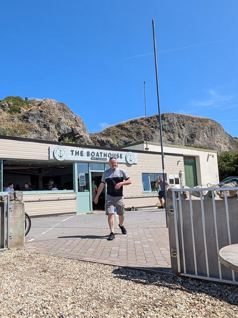
Their fish-finger sandwiches were just what I needed to fuel the rest of the cycle ride up to Weston Pier.
We cheated here as the tide was out and we could see no reason not to pedal along the wide open beach with its firm sand. You could have landed a brace of jumbo jets on that broad littoral quite safely.

Then it was back against a stiff wind all the way to Brean, and then up that near vertical section to the top of the giant finger that points, so accusingly, at that foreign land known as Wales. Do not be put off by the climb - the ride along to the impressive fortifications at the end of Brean Down is as scenic as any cycleway anywhere in England.

Frequently asked questions about the Brean Down Way
How long is the Brean Down Way?
The Brean Down Way is about eight miles from Weston-super-Mare to Brean Down, following National Cycle Network Route 33. It is largely traffic-free and relatively flat for most of its length.
Is the Brean Down Way suitable for cycling?
Yes. The route was specifically developed as a walking and cycling route and is mostly away from busy roads. It is a relatively easy ride for much of the way, although there are a few places where cyclists need to take care.
Can you cycle all the way to the top of Brean Down?
Not quite. The section between the National Trust café and the bottom of the road onto Brean Down is a private road where cyclists are asked to dismount. The climb onto Brean Down itself is also steep, so this is the part of the journey where you'll want to leave the cycling behind and walk.
Is the Brean Down Way mostly flat?
Yes. The main route is predominantly level, with the more substantial climb coming when you leave the cycle route and head up Brean Down itself.
How long does it take to cycle the Brean Down Way?
Allow around an hour for the eight-mile route if you're cycling steadily, but considerably longer if, like me, you stop to enjoy the scenery, take photographs and explore places along the way.
Where does the Brean Down Way start?
The route connects Weston-super-Mare with Brean Down. From Weston it begins around the seafront and Grand Pier; from the Brean end it connects into the road and paths around Brean.


