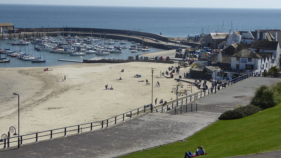
Jurassic Coast Walks: 5 Great Routes in Dorset and East Devon


Walking the high ramparts of the Jurassic Coast is an exercise in sublime impermanence. Nowhere else in Britain does the solid earth beneath your boots seem quite so eager to pack its bags, give up its ancient day job as a clifftop, and slide bodily down into the churning sea.
From the golden heights of the South Coast’s tallest peak to the fossil-strewn undercliffs of Charmouth and the windswept shingle curves stretching towards Portland, West Dorset and East Devon offer some of the most exhilarating walking anywhere in the realm. It is high ridge country, knobbly green vales, and dramatic precipices.
Here are five of my favourite coastal rambles along this ever-shifting shoreline - ranging from strenuous clifftop ascents to gentle village-and-beach loops - followed by a nostalgic look back at how we first learned to journey through its deep, prehistoric time.

1. Golden Cap: Crown of the South Coast
Travelling through Dorset in no particular hurry, I found myself in high ridge country and decided to go for a hike. My brother was with me, and we initially tackled Pilsdon Pen - Dorset’s highest inland hill. It ticked most of the right boxes, but the photographs didn't. Walking on those magnificent inland ridges is all about views, and in dank, iron-grey misty weather, airy heaths giving way to vast panoramas simply vanish.
READ THE FULL WALK DESCRIPTION OF A HIKE FROM GOLDEN CAP HERE

Save for the nearest group of hills to the south, we could hardly see a thing. So, allow me to feature the wondrous, sunshine-lit Golden Cap walk instead - with a firm promise that we will return to march across Pilsdon Pen on a brighter day.
Golden Cap is the highest point along the entire English south coast, standing proudly at 191 metres (627 feet). Climbing its summit from sea level is a lung-busting haul for all but the fittest, but the great hill looming between Lyme Regis and Bridport is attached to a high plateau offering fantastic level walking and heavenly panoramas.
The Route To find this altitudinous demesne, head to the hilltop village of Morcombelake on the A35 between Charmouth and Chideock. Just past the garage, heading east, watch out for a tiny lane on the right (take great care crossing the traffic). Turn left where marked for Langdon Hill car park. Here, tucked into National Trust woodland at 600 feet, you start at almost the same altitude as Golden Cap itself.
Head due south down the broad forest ride. Leaving the trees, you are treated to huge views over Chideock lying far below among those Hobbit-like vales for which West Dorset is justly celebrated.

Instead of tackling the Cap straight away, turn right and head past the ruined St Gabriel’s Chapel in a corner of the fields. Follow the path inland past St Gabriel’s Wood and climb to the farm at Upcott, where another path ascends west onto Chardown Hill. A long, straight track heads along the ridge—which becomes Stonebarrow Hill—eventually meeting a paved lane running down towards Charmouth.
Where track turns to tarmac, turn sharp left and descend seawards past Westhay Farm and into the two glorious little coombes formed by Westhay and Ridge Waters. These fields are managed by the National Trust with a strict limit on pesticides, making them a haven for wildflowers and butterflies (and a pollen hazard for hay-fever sufferers in early summer).
Now comes the big climb. The coast path goes straight up the contours to the peak of Golden Cap without any polite zig-zagging. It is one long, unvarnished haul—yet worth every gasp. To the north sits Pilsdon Pen; to the west, gargantuan landslides tumble past Charmouth towards The Spittles and romantic, Jane Austen-esque Lyme Regis; and to the east, Seatown sits deep in its gully, backed by the rolling spine of Thorncombe Beacon.
From the summit plateau and its Bronze Age barrows, retrace your steps across the dip to Langdon Hill, taking the western woodland track back to the car park.
Distance: 8 miles
Difficulty: Strenuous; steep climbs and descents
Starting Point: National Trust Langdon Hill Car Park (DT6 6EP)

2. West Bay & Burton Bradstock: Beyond Broadchurch
The world went mad for the television series Broadchurch, filmed right along these honey-coloured cliffs. ITV produced a brilliant drama, but when I head to the coast for a hike, I prefer not to dwell on sinister fictional crimes and murdered children.
What I do like is a stroll based in the far-flung chalklands of Wessex—no heather moorland or craggy granite here, but an expansive coastal demesne full of rural charm.
READ MORE ABOUT THE DELIGHTS TO BE FOUND AROUND WEST BAY HERE

The Route West Bay bustles with fish-and-chip kiosks, bobbing boats, and rows of static caravans. To turn this coastal outing into a circular ramble, avoid heading straight out along the cliff edge and instead take the public right-of-way heading slightly inland along the shallow valley behind East Cliff.
The path carries you directly into Burton Bradstock—a gorgeous, thatched village of 1,000 souls clustered around a 15th-century church. It has a proud working heritage: during the 16th century, Bridport guarded its naval rope-making monopoly so jealously that Parliament banned rope production within five miles, yet 19th-century census records show Burtonians were still vigorously weaving twine, nets, and sailcloth.
From the village centre, take the footpaths heading south up the hill to reach Burton Beach, where the vast, shingle sweep of Chesil Beach curves away toward distant Portland Bill.
A stern warning: The golden grit along the shoreline has an annoying habit of giving way underfoot, making one mile feel like three. Worse still, these soft sandstone cliffs are prone to sudden, lethal collapses. Give them a very wide berth.

At Burton Freshwater, head inland around the stream and cross the footbridge before tackling the short, sharp climb to gain the top of East Cliff. The walk back to West Bay along the clifftop is a pure dawdle, offering magnificent coastal vistas every yard of the way.
Distance: 4.5 miles
Difficulty: Easy to moderate; shingle walking can be tiring
Starting Point: West Bay harbour or pay-and-display car parks (DT6 4EL)

3. Charmouth & The Moving Earth
I once found myself in Charmouth covering a major cliff fall alongside dozens of other journalists. Unlike colleagues who had to rush back to distant city desks to file, my copy was sorted early, leaving plenty of daylight for a brisk circular hike.
In Charmouth's prehistoric heyday 195 million years ago, early visitors would have been ordering ammonites rather than oysters and dodging toothy Eugnathus orthostomus fish. The landscape here still behaves as though it has an innate desire to abandon its position as high clifftop and take up residence on the seabed.

The Route The porous sandstone here rests on slick, tilted beds of impermeable clay; add heavy winter rain, and entire hillsides shear away. This creates the extraordinary coastal wilderness known as the "Undercliff"—a tangled, stepped wonderland where full-grown trees slip downhill into inaccessible sanctums untouched by human boots.
Ascend the eastern flank out of Charmouth up towards Cain’s Folly (if the cliff-edge section is shut due to active falls, use Stonebarrow Lane as the designated bypass to reach the top). Skirt the rim of the great slips, enjoying spectacular views back toward Golden Cap.
Descend into the coombes carved out by Westhay Water and Ridge Water, then climb past Broom Cliff. Turn inland toward Upcott, picking up the quiet lanes and field paths that lead steeply onto Chardown Hill.
A companion once insisted to me that Golden Cap was the highest point in these parts; I won a very pleasant ice cream by proving that the inland crest of Chardown Hill is, in fact, three metres taller - but of course it is slightly inland - Golden Cap gets its fame for being the tallest hill along the whole South Coast. Traverse Stonebarrow Hill westwards—passing the old National Trust radar station—before descending Stonebarrow Lane back into Charmouth.
Distance: Just under 5 miles
Difficulty: Moderate; a couple of short, steep climbs
Starting Point: Charmouth foreshore car park (DT6 6LS)

4. Lyme Regis to Charmouth: The Ghost Path
I once embarked on this route on the hearty recommendation of the brilliant press photographer Richard Austin. He promised me fantastic views, and my neighbour Mark joined me for a birthday walk. What Richard neglected to mention was that the original path no longer exists—it lies scattered across the seabed, and attempting the old route could land you a hefty fine.

My Ordnance Survey map showed an innocent footpath running along the foot of the immense grey vertical slips of The Spittles. It has long since dissolved into the waves. Higher up, the official South West Coast Path has had to pull off several dramatic inland retreats from the crumbling lip of Timber Hill.
The Route From Lyme Regis, park half a mile up the A3052 on the Charmouth side. Above the football club, the path strikes out across fields toward a high wood (a sea of bluebells in late spring).
Crucial rule: Do not attempt to hug the direct cliff rim or wander onto the golf course where old routes met sheer drops. Follow the signposted, diverted inland route along the higher boundary. It involves a stiff climb alongside massive, labyrinthine badger setts before working eastward above the ancient active slips.

Eventually, you will drop down into Charmouth. To return, you have three sensible choices:
Retrace your steps along the designated inland diversion.
Catch the regular Jurassic Coaster bus back up the hill to Lyme.
Walk back along the beach at low water - only attempt this on a falling tide, well clear of the unstable cliffs, as an incoming tide will pin you against sheer rock.
(My own solution was to telephone the guilty photographer and persuade him to drive out and collect us.)
Distance: 2.5 miles one-way (approx. 5 miles return via inland diversion)
Difficulty: Moderate to steep; strictly follow current local signage and path diversions
Starting Point: A3052 car park above Lyme Regis (DT7 3HQ)
READ ALL ABPOOUT A MACKERAL FISHING ADVENTURE OUT OF LYNME REGIS HERE

5. Seatown to Eype Mouth: Doghouse Hill & Smugglers' Ridges
Seatown has long been one of my favourite West Dorset boltholes. It features The Anchor inn right on the shingle fringe, and unlike landowners further west who charge an arm and a leg for a patch of mud, beachside parking here has always retained a modest, sensible charm.

It was also once the epicentre of 18th-century smuggling. The notorious "Chideock Gang"—led by an elusive former military gentleman dubbed "The Colonel"—used the looming height of Golden Cap to spot Revenue cutters miles out to sea, dropping kegs of contraband into the bay to be dredged up under cover of darkness.
The Route Facing the sea, turn east and tackle the formidable bulk of Doghouse Hill. The climb is sharp, but looking back provides an astonishing perspective of Golden Cap and the rolling green farmland of the Chideock vale.
Continue along the clifftops toward Thorncombe Beacon. The ground here is one gigantic rabbit warren, patrolled by coastal ravens. The steel brazier atop the beacon—one of the chain that warned of the Spanish Armada in 1588—still marks the summit. From here, the panorama sweeping along the entirety of Chesil Beach to Portland Bill is arguably one of the greatest coastal views in Britain.
Descend into the quiet cleft of Eype Mouth, where a tiny stream cuts through to a tranquil gravel strand.

From the beach, amble inland to the hamlet of Lower Eype, then turn west onto the field paths climbing toward Down House Farm. From here, pick up the high trail (joining a section of the Monarch's Way) that traverses the inland flanks of Doghouse Hill. It delivers you gently back down into Seatown, offering peaceful, sylvan views across the pastoral shires of Dorset before you sink into a well-earned seat beside the waves.
Distance: 4 miles
Difficulty: Moderate to strenuous; sharp climbs up Doghouse Hill and Thorncombe Beacon
Starting Point: Seatown beach car park (DT6 6JU)

Time-Travel at Seaton: A Coastal Gateway
Just across the Devon border, the gateway town of Seaton provides the geological foundation stone for this entire stretch of coast.
A few years ago, the opening of the £4 million Seaton Jurassic centre gave visitors a taste of deep time. Operated by the Devon Wildlife Trust, the attraction was designed around a Victorian collector's study and a whimsical, spherical "time-ship." Visitors could literally step inside, grab the oars, and "row" their way down through ancient warm oceans, watching 160-million-year-old pliosaurs glide past the portholes and dodging digital giant cuttlefish.
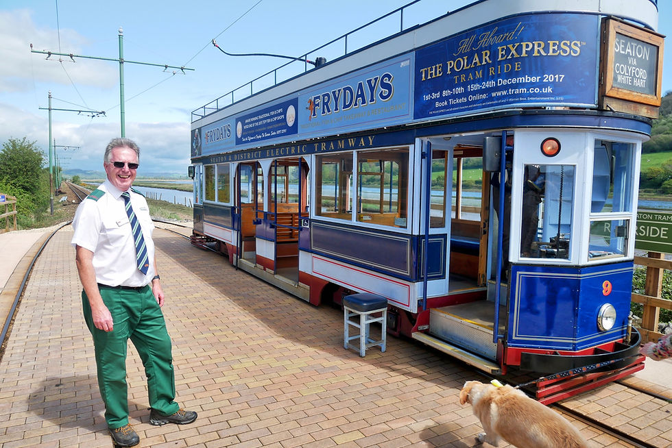
While the physical centre has since evolved into the Seaton Tramway’s Jurassic Discovery centre (housing soft-play and an immersive animatronic dinosaur exhibition), the core lesson of this coastline remains unchanged: every pebble underfoot at Seaton, Charmouth, or Lyme is a window into 250 million years of Earth's restless history.
Whether you are hunting for pyritised ammonites along the foreshore or striding out across the high turf of Golden Cap, there is no better place in Britain to lace up your boots and watch geology in motion.

Fossil Hunting on the Jurassic Coast: Essential Safety & Beach Code
Along the foreshores of Charmouth and Lyme Regis, Mary Anning’s legacy lives on in every cracked nodule and glistening ammonite spiral. But searching for prehistoric relics on this restless coast requires respect—both for personal safety and for the protected landscape itself.
Here is what every walker and beachcomber needs to know before venturing onto the gravel beds:
1. Watch the Tides Like a Hawk
The Rule of a Falling Tide: Always hunt on an ebbing (falling) tide. Never head out around headlands—especially between Charmouth and Lyme Regis, or toward Cain’s Folly—on a rising tide. The sea pushes right up against vertical mudstone cliffs, and people are cut off with alarming regularity.
Know the High Water Times: Check local tide tables before you step onto the shingle, and aim to be safely off the beaches at least two hours before high water.
2. Give the Cliffs a Wide Berth
Falling Rocks Kill: The soft clays and shales of Black Ven, The Spittles, and Stonebarrow are constantly shedding rock. Frost, rain, and heat all trigger sudden rockfalls.
Keep Your Distance: A good rule of thumb is to stay a distance away from the cliff base equal to at least the height of the cliff. Never sit, picnic, or linger beneath overhangs.
Avoid Mudflows: The vast landslips create deep, liquid mud "glaciers" on the lower slopes that look deceptively firm. Stepping onto them can sink you waist-deep in seconds.
3. Leave the Cliff Faces Alone (The West Dorset Fossil Code)
No Digging in the Cliffs: Hammering, picking, or chiselling directly into the cliff faces or vegetated slopes is strictly prohibited. It destabilises the cliffs, accelerates dangerous rockfalls, and damages the Sites of Special Scientific Interest (SSSI).
Search the Foreshore: The best, safest, and most responsible finds are already loose on the beach. Look among the shingle lines, tideline drift, and loose tumbled rocks on the foreshore where the sea has naturally washed the fossils clean.
Safety Glasses are Essential: If you do tap loose beach stones with a geological hammer, always wear proper eye protection—flint and pyrites splinter like shards of glass.
4. Recording Rare Finds
Loose, common fossils like small ammonites, belemnites, and fossilised wood are fine to collect in moderation.
If you discover a significant vertebrate fossil—such as ichthyosaur bones or rare prehistoric fish—do not attempt to excavate it yourself. Take photos, record the exact location, and notify the Charmouth Heritage Coast Centre or the Lyme Regis Museum so trained geologists can assess and preserve it for science.