
4 Essential Circular Walks Across Wild Exmoor


Sometimes there’s nothing for it but to reach the roof of the world. What a person needs is altitude. He or she needs air and space — and lots of it.
Here in the West Country we are lucky because we have some of the best spaces imaginable that can assuage the yearning for the wide open emptiness which only highland wilderness can offer. Dartmoor has its swathes and Bodmin Moor has some excellent sweeping scenery too — but there is one central area of Exmoor that particularly fits the bill. From the great void of the central moors to dark evergreen oak forests tumbling down to the Severn Sea, these four classic circular walks offer the very best antidote to modern life.

If you're planning a walking weekend in central Exmoor, local pub-inns and holiday cottages fill up quickly during peak season. You can check real-time availability and compare local stays using our interactive map below:
1. Larkbarrow Corner & Beckham Circular
The great waste — to use that word in the old-fashioned sense — that lies west of the Dunkery range is Southern England’s answer to the African savannah or the Russian steppes. It is a primeval landscape which has more or less been untouched by the hand of man. Stand in its midst and the only straight line of man’s making you may see is the vapour trail of an airliner. Everything else will be as nature intended — the England of the giant aurochs, where great herds of big animals would have once roamed unmolested.

To find it, march west from Larkbarrow Corner out into the middle of nothing — or rather, onto a big bald hill known as Elsworthy — following the contour high above the deep ravine of the Exe to find the shallow workings of what was planned as the trans-Exmoor canal. Leaving the waterway as it rounds Ware Ball, a right-to-roam takes you north into the great area of nothing toward Beckham (a birthplace of a hundred springs) before dropping into the East Lyn valley system to return via the bullet-scarred Second World War ruins of Larkbarrow Farm.
(IF YOU ENJOY THIS POST CHECK OUT OUR EXMOOR WALKS PAGE HERE)

Route Summary
Start / Finish: Larkbarrow Corner (Exford/Porlock road)
Waypoints: Larkbarrow Corner ➔ Ware Ball (Trans-Exmoor Canal) ➔ Beckham ➔ Larkbarrow Farm (Ruins) ➔ Larkbarrow Corner
Fact File
Basic Hike: From Larkbarrow Corner west around Ware Ball, north to Beckham (map ref: SS419807), north-east to Larkbarrow Farm, and back to start.
Distance & Going: 5 miles. Fairly easy underfoot, though can be very boggy in places.
Recommended Map: Ordnance Survey OL9 Exmoor.
Local Pubs & Tea Rooms:
The Exford White Horse Inn (Exford) — A classic country inn serving hearty local food, right on the River Exe.
The Crown Inn (Exford) — Atmospheric 17th-century coaching inn offering great local ales and pub classics.
Places to Stay:
The White Horse Inn (Exford) — Comfortable riverside hotel rooms.
Rest and Be Thankful (Wheddon Cross) — Traditional moorland accommodation nearby.

2. Brendon Common & Oare Valley Circular
There is only one way of combating a debilitating bout of other-people’s-grass-is-greener blues if you cannot afford to belt off to the tropics: get out into the countryside and enjoy winter walking at its very best. Stopping your car at Dry Bridge on a cold day, you might be extremely loathe to get out - but do so, and you'll enjoy one of the best hikes in a twelve-month.

Following the track north across Tippacott Ridge, you might, if you're lucky, come across one of the biggest herds of wild Exmoor ponies on the high moor. Descending down the hill to Brendon via Cross Lane, you enter an ancient community where, on a bitter day, you can almost feel the company of the 12th-century hermits of Bagawordia before tucking into a warming lunch at the local inn. The return route climbs steeply up through the wooded goyle of Deercombe to the remote, brooding farmstead at Shilstone — where you can imagine the likes of Heathcliff strutting about being moody — before crossing the featureless plain of Shilstone Hill back to your vehicle.

Route Summary
Start / Finish: Dry Bridge (B3223 on Brendon Common)
Waypoints: Dry Bridge ➔ Larkcombe Ford ➔ Tippacott Ridge ➔ Brendon Village ➔ Rockford Road ➔ Deercombe Goyle ➔ Shilstone Farm ➔ Shilstone Hill ➔ Dry Bridge
Fact File
Basic Hike: From the B3223 on Brendon Common, east to Larkcombe Ford then north to the village of Brendon — returning via the Rockford road then south to Shilstone and over Shilstone Hill to Dry Bridge.
Distance & Going: 7 miles. Fairly easy going, with one steep climb.
Recommended Map: Ordnance Survey OL9 Exmoor.
Local Pubs & Tea Rooms:
The Staghunters Inn (Brendon) — A traditional, welcoming moorland pub nestled in the valley, ideal for lunch.
The Rockford Inn (Rockford) — A secluded riverside pub set deep in the Brendon Valley.
Places to Stay:
The Staghunters Inn (Brendon) — Characterful rooms set right on the walking route.
Duchy House Bed & Breakfast (Brendon) — Cozy B&B accommodation in the heart of the valley.
(YOU CAN FIND A LARGE SELECTION OF WALKS IN DEVON HERE)

3. Selworthy Beacon & Coastal Woods Circular
Selworthy is the calendar-classic jewel in West Somerset’s crown. Home to a hundred hikes — each more picturesque, dramatic and ruggedly rural than the next — it offers deep, moody woods, swathes of high moorland heather, vast Exmoor panoramas, and wild salty glimpses of the Severn Sea.
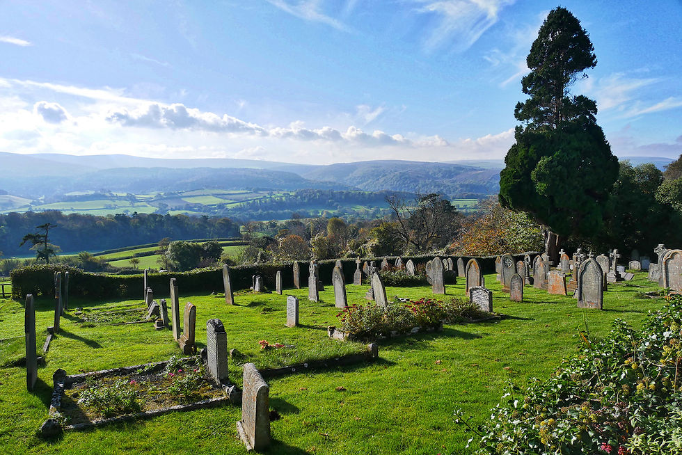
Starting from the church car park above the idyllic thatched cottages on The Green, a footpath leads north up wooded Selworthy Combe past Lady Acland’s Hut and the carved poetry of the Wind and Weather Hut. Reaching Selworthy Beacon yields an awesome 360-degree aspect taking in Wales, the Bristol Channel, the Quantocks, the Brendons, and Dunkery vast and looming to the south. Heading west along a stretch of the South West Coast Path above Bossington, you plunge back into dark forests of evergreen oak (Ilex) — the largest stand of Ilex in Britain — before the path deposits you back on The Green for a cream tea.

Route Summary
Start / Finish: Selworthy Church Car Park
Waypoints: Selworthy Green ➔ Selworthy Combe ➔ Lady Acland's Hut ➔ Selworthy Beacon ➔ South West Coast Path ➔ Hurlestone Point / Ilex Forest ➔ Selworthy Green
Fact File
Basic Hike: From Selworthy up through the woods to Selworthy Beacon, returning via a more westerly route through the evergreen oak forest.
Distance & Going: 6 miles. Steep in places.
Recommended Map: Ordnance Survey OL9 Exmoor.
Local Pubs & Tea Rooms:
Periwinkle Tea Room (Selworthy Green) — Traditional thatched tea-room serving quintessential Exmoor cream teas on the green.
The Bossington Tea Room (Bossington) — Charming nearby stop for home-baked cakes and light lunches.
Places to Stay:
Selworthy Lodge (Selworthy) — Peaceful guest accommodation close to the village green.
The Cross Lane House (Allerford) — Boutique country hotel nestled in the neighbouring village.

4. Withypool Common & The River Barle
Withypool Common is a direct survival of the era when the Royal Forest of Exmoor was still an open waste, before the Inclosure Act of 1815. Today it remains an unspoilt haven of customary grazing rights, verderers, Court Leets, and sweeping river vistas.

Climbing around the spur of hill due north from Upper Willingford Bridge leads past Porchester’s Post to Brightworthy Burrows. At 428 metres, this offers a fine prospect of central southern Exmoor, with famous Landacre Bridge looking lonely in the valley of the Barle below. Dropping down to follow the clear waters of the river east into Withypool brings you to the village, where you can take refreshment before tackling the ascent of Withypool Hill. Passing the summit tumulus and an ancient stone circle, you rejoin the track heading south-west past Tudball’s Splats back to Willingford Bridge.
(TAKE A LOOK AT OUR DARTMOOR WALKS PAGE HERE)

Route Summary
Start / Finish: Upper Willingford Bridge (map ref: SS325 815)
Waypoints: Upper Willingford Bridge ➔ Porchester's Post ➔ Brightworthy Burrows ➔ River Barle Footpath ➔ Withypool Village ➔ Withypool Hill ➔ Tudball's Splats ➔ Upper Willingford Bridge
Fact File
Basic Hike: From Upper Willingford Bridge north to Brightworthy Burrows, down to the footpath along the Barle, east to Withypool, and south to return over Withypool Hill.
Distance & Going: 9 miles. Fairly easy going, can be a bit squelchy after rain.
Recommended Map: Ordnance Survey OL9 Exmoor.
Local Pubs & Tea Rooms:
The Royal Oak Inn (Withypool) — Historic 17th-century pub frequented by R.D. Blackmore and General Montgomery, serving great food and local ales.
Withypool Village Shop & Tea Room — Excellent stop for hot tea, pasties, and cakes right by the bridge.
Places to Stay:
The Royal Oak Inn (Withypool) — Traditional pub rooms in the center of the village.
Westermill Farm (Withypool) — Self-catering cottages set in a picturesque valley along the Barle.

If you are planning a short break to tackle a few of these routes, central Exmoor fills up quickly during the warmer months. I've set up an interactive map where you can check live availability for local pub-inns, village B&Bs, and countryside stays across the moors:
Frequently Asked Questions About Walking on Exmoor
What is the best circular walk on Exmoor for pub stops?
The Brendon Common & Oare Valley Circular (7 miles) and the Withypool Common & River Barle Walk (9 miles) both offer excellent mid-walk pub stops. In Brendon, you can pause at The Staghunters Inn or The Rockford Inn, while Withypool features the historic 17th-century Royal Oak Inn.
Where do you park for the Selworthy Beacon circular walk?
The best starting point for the Selworthy Beacon walk is the Selworthy Church car park (just above Selworthy Green). From here, well-marked footpaths lead north up through Selworthy Combe directly to the Beacon.
Are these Exmoor walking routes dog-friendly?
Yes, all four routes follow public rights of way across open moorland, woodland, and valley tracks. However, because free-roaming Exmoor ponies, red deer, and grazing sheep live on the commons year-round, dogs should be kept under strict close control or on a lead.
What map do I need for walking central Exmoor?
The recommended map for all four walks is the Ordnance Survey Explorer OL9 (Exmoor) 1:25,000 scale map, which clearly shows public rights of way, open access land, and moorland contours.
(SEE MORE SOMERSET WALKS HERE)


