
Langport to Muchelney Walk: A Beautiful Somerset Levels Circular

Updated: Aug 28
Langport to Muchelney: Walking Through the Somerset Levels
The Langport to Muchelney circular is one of my favourite ways of discovering the quieter side of the Somerset Levels. It is an easy, largely flat walk of around four and a half miles, taking you from the old market town of Langport across open moorland to the ancient settlement of Muchelney before returning beside the River Parrett.
What makes this walk special isn't any single dramatic viewpoint. It is the enormous sense of space: big skies, distant church towers, winding waterways, old hedgerows and the strange feeling that you have wandered into a piece of rural England that time forgot.
There is history everywhere, too. The route uses the trackbed of a long-closed railway, passes close to ancient Muchelney and follows the River Parrett back towards Langport. And, if you keep your eyes open, the Levels can provide a wonderful wildlife spectacle along the way.
Langport and its Vibrant Community
The communities of the Somerset Levels needed some help the last time I wrote about this walk. The area had been hit badly by the infamous flood of 2013/14 and I wrote in the newspapers how it could do with our business when the waters had gone away.
So I sat down to write about one of the region’s best lowland perambulations in the hopes that readers would go out and enjoy the later in the year.
“If you do, please call in at a local pub or other business and give them a bit of your trade,” I wrote. “I have interviewed people - and indeed have friends out on the Levels - who’ve taken a big financial hammering from the floods and they could do with all the help they can get. “
You will be well rewarded - this is a walk where Rembrandt seems to meet Constable, with a bit of Renoir thrown in for good measure - a place where the English countryside seems to blend with lowland northern Europe to produce enormous, Flemish-inspired skyscapes, dotted with churches and trees.

The vistas to be enjoyed on a stroll across the Levels are as dramatic and as beautiful as any to be found in the South West, and yet most visitors on their way to our wonderful peninsula experience them only from the busy carriageways of an Atlantic-bound motorway or the windows of the mainline train.

Well, let me tell those of you who aren't already in on this little secret… So excellent and inspiring is a walk in the Wetlands that it should be a compulsory fixture on the days-out agenda of anyone who happens to live within the area covered by this newspaper. And this little four-and-a-half-mile meander is as good an introduction as any when it comes to hiking on the flat.

It's a stunningly beautiful circular walk that leads you across the moors from Langport to the ancient and recently much-publicised hamlet of Muchelney - then back to the other side of the old trading town along the banks a lazy, winding, and hopefully unflooded river.


At a Glance: Langport to Muchelney Circular
Distance: approximately 4½ miles
Type: Circular walkTerrain: Predominantly flat
Starting point: Langport
Highlights: Somerset Levels, River Parrett, Muchelney, old railway line and abundant birdlife
This is an especially good walk if you enjoy landscape rather than strenuous hill climbing. The route crosses the flat countryside of the Somerset Levels and follows well-established paths and embankments, although conditions can obviously become much wetter after prolonged rain.
Allow plenty of time rather than treating the four-and-a-half miles as a race. The pleasure of this walk is in the details: looking across the rhynes, watching birds along the river and taking in the extraordinary skies of the Levels.
Easy Walking
Easy walking it is too, thanks to the dead-flat path along the embankment of a disused railway. You’ll find the old Taunton to Yeovil branch-line on the western edge of Langport, across the river from the main town, under Hurd’s Hill.
I’ll admit to suffering a little bout of wrath whenever I think of Dr Beeching's crazy and misguided axe… However, you couldn't be angry for long out here on a pleasant day. So fabulous are the views along this straight, raised, section of the walk that the merry walker might even be tempted to forgive the good doctor for closing down so many excellent railway lines.
Instead of being run down by a train the last time I did this walk - which was 10 years ago in a high, dry, summer - I was accosted by flurries and drifts of butterflies. Gate-keepers, peacocks, fritillaries - you name it, the Taunton to Yeovil branch-line had them all.

But after a mile or two on the beautiful butterfly special, it was time to leave the line and turn left along the Law Lane to cross the River Parrett via Westover Bridge. Instantly you will find yourself in deepest rural Somerset. You have been in it all the way of course but, if there's something frenetic about a dead railway mad with life, then there's something profoundly silent and Mediaeval about approaching lonely, lovely, Muchelney.

Muchelney: An Ancient Island in the Somerset Levels
The approach to Muchelney is one of the most atmospheric parts of the walk. The hamlet seems to rise out of the surrounding Levels almost like an island, which is no accident: the name itself reflects the area's ancient watery landscape.
The great landmark here is Muchelney Abbey, founded in the seventh century and later home to Benedictine monks. Its ruins, the medieval buildings around it and the nearby church give this tiny settlement an extraordinary sense of age. Even if you don't detour to visit the abbey, it is worth taking time to look around Muchelney before continuing your walk.
After the wide-open landscape of the Levels, the village can feel almost impossibly intimate – thatched buildings, old walls and the church rising above them. It is one of those Somerset places where the past seems unusually close to the surface.
When the media hordes aren’t here in the floods, you almost expect the music of Thomas Tallis to come wafting across the moors from the ancient abbey, so enshrined in religious history does the hamlet seem. Whether it's the thatch sitting on top of just about every building bar the church, or simply the island-at-sea look of the place, Muchelney speaks of the past with the same permanent air as Stonehenge or the Acropolis.

To be honest I don’t know if the tea-rooms situated in venerable stables, where I had a bite and a brew a decade ago, are or will be open after the Great Flood of 2014. If they are, why not go in and give them your custom.
Across the road the walls of Benedictine Abbey (run by English Heritage - open to the public) still stands strong and proud despite the threatening waters - having kept their occupants dry and holy for more than a 1,000 years. Men were praying inside those walls before William the Conqueror was even a twinkle in a pair of Norman eyes. Since 950 to be precise, when King Athelstan had the place rebuilt - and some 300 years before that if you count the abbey which this replaced.

If you are in the mood to check out local businesses during this walk, why not stroll a quarter of a mile up the road to the Leach Pottery where one of the world’s most avuncular and well known potters plies his trade. John Leach’s establishment is always well worth a visit - unless it’s been closed for weeks by floods which it has a good deal of late.

Last time I was out this way I took a quick look around Muchelney Church before returning north to Langport, and have to report I was in for a bit of a shock. I knew the place had a rather famous painted ceiling, but didn't know why it had achieved acclaim. If you’re of an extremely prudish disposition, best avert your eyes.
Inside the marvellous old church there is a mirror which has been placed on a table in the central aisle so that visitors can admire the ceiling without craning their necks. The wood carver was what you might call a 'breast-man'. In other words the girls upstairs, or angels I suppose, are the 15th Century's answer to Page Three models.

They bare not the biggest breasts in the world, nor are they the best painted bosoms I have ever seen. But breasts they certainly are and there are enough of them to convince you that the fellow was obviously obsessed.
Quite enough in fact to make you seek sanctuary - in the Sanctuary - and admire the Mediaeval tiles which adorn the floor. When the architects of old went shopping in Bridgwater it wasn't the cut-price big-sheds on the outskirts for them, but the chic little places selling exotica in town. Where else, back then, would you have found tiles depicting elephants? Come to that, how did the local tile-makers even know what elephants looked like?
So many puzzles in just one church. Enough to keep you pondering on the most beautiful part of the hike as you return to Langport along the banks of the River Parrett. By returning to Westover Bridge you have a choice - you can walk along either bank as both have public footpaths running along their length. The east bank will provide you with a slightly longer hike as it eventually swings right to allow you to cross Bicknell (road) Bridge.
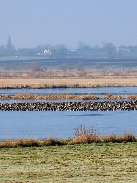
I took the left bank when I was last here. On a good day you will see bending reeds, parting to reveal herons, swans, ducks, curlews, buzzards, kingfishers and lapwing… All will keep you company as you head for the Somerset town which is southern England’s answer to Holland.
Having referred to that flat country it must be said that part of Langport sits on a steep hill which, I admit isn't particularly Dutch - but it's the Flemish architecture which rears so many conspicuous gabled-ends here and there, that puts one in mind of the Lowlands.
Crossing Huish Bridge you can either climb the hill directly in front of you and enter town to regain your car by walking left past the main church, or stroll down the riverside path. A decade ago on my summer stroll here I saw kids diving in and out of the slow moving Parrett and the idyllic scene looked for all the world like Renoir’s painting The Bathers.
Langport is also a town of great community interest - led by people like the two town councillors Ian MacNab and Val Saunders (below).

Frequently Asked Questions
How long is the Langport to Muchelney walk?
The circular route is approximately four and a half miles, making it a manageable walk for most reasonably fit walkers.
Is the Langport to Muchelney walk flat?
Yes. This is predominantly flat walking across the Somerset Levels, with much of the route following embankments, old railway track and riverside paths.
What are the highlights of the Langport to Muchelney walk?
The main highlights include the Somerset Levels, the old Taunton to Yeovil railway line, Muchelney and its ancient abbey, the River Parrett and the abundant wildlife of the wetlands.
Can you see wildlife on the Langport to Muchelney walk?
Yes. The wetlands and river provide habitat for numerous birds, and Martin has recorded seeing herons, swans, ducks, curlews, buzzards, kingfishers and lapwings along the route.
Is Muchelney worth visiting?
Absolutely. Muchelney's ancient abbey and historic buildings make it one of the most atmospheric settlements on the Somerset Levels, and the village provides a memorable addition to the walk.


