6 Great Circular Pub Walks in Somerset: Coastal Hikes, Quantock Ridges & Historic Country Inns


Somerset is a county custom-made for walking. From the maritime cliffs of Exmoor and the red sandstone combes of the Quantock Hills to the dramatic ancient mounds rising out of the Somerset Levels, it is a landscape made for exploring on foot. But nothing completes a West Country stroll quite like the prospect of a cosy bar, a roaring fire, and a cool glass of regional ale or traditional farmhouse cider along the way.
Here are six of the very best circular pub walks in Somerset, drawing on classic routes across coastal paths, historic deer parks, ancient hill forts, and peaceful marshland dales.
ALSO CHECK OUR PUB WALKS IN DEVON
AND OUR PUBS WALKS IN CORNWALL

1. The Culbone Coastal & Woodland Loop (Porlock Weir)
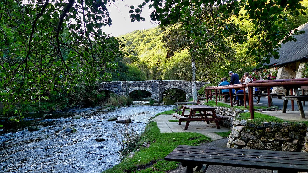
Despite not being a churchgoer, visiting remote and arcane Culbone - home to the smallest complete church in England - evokes hallowed and spiritual sensations like nowhere else in the West Country. Tucked away in an enchanting glen high above the grey rocks of the Bristol Channel, you cannot reach Culbone by car; to experience its quiet magic, you must walk.

This dramatic six-mile circuit sets off from the harbour at Porlock Weir, winding past the thatched archway of Worthy Toll Road and climbing through fairytale-like Yearnor Wood. Here, Lady Lovelace once built a fantasy mansion flanked by miniature castles, tunnels, and stone carriageways engineered by Swiss mountaineers. After visiting the tiny 35-foot-long parish church, the route climbs up over Culbone Hill (keep an eye out for prehistoric stone rows among the pine trees) before looping back down through the quiet woods of Smalla Combe and Worthy to the sea.
Fact File
Distance: 6 miles
Terrain: Coastal woodland paths and steep hill tracks (can be muddy in places).
Recommended Map: OS Explorer OL9 (Exmoor).
Pub Stop: The Ship Inn, Porlock Weir — Known locally as "The Bottom House," this thatched 13th-century inn sits right by the quay, serving local real ales and classic pub fare.

2. Dunster Castle, Carhampton & The Coast (Blue Anchor)
Where the parish meets the Bristol Channel at Blue Anchor, this varied six-mile hike offers an invigorating mix of maritime breezes, ancient village history, and parkland vistas.
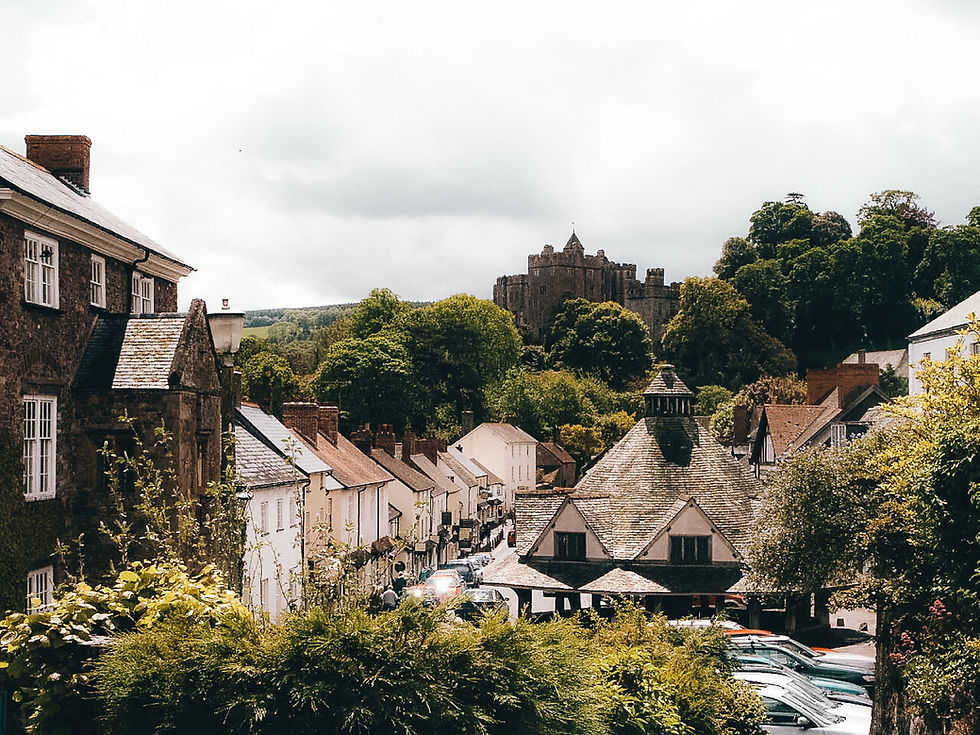
Starting near the seafront at Blue Anchor, the path marches inland alongside the West Somerset Railway before delivering you into the ancient Hundreds of Carhampton ("Cramp'n"). Passing the historic orchard behind the local pub—where the tradition of the midwinter Wassail has been celebrated for over a millennium—the trail ascends gently into the estate of Dunster Castle. Here you'll enjoy sweeping views across the Avill Valley before crossing the medieval Gallox Bridge. Pick your way through Dunster’s cobbles, cross beneath the main road, and head back along the beach from Dunster Marsh to Blue Anchor.

Fact File
Distance: 6 miles
Terrain: Fairly level paths, country lanes, and coastal high-tide tracks.
Recommended Map: OS Explorer OL9 (Exmoor).
Pub Stops:
The Butcher's Arms, Carhampton — A classic village local situated right in the heart of historic Carhampton.
The Luttrell Arms, Dunster — A grand 15th-century hotel and inn facing Dunster’s famous Yarn Market, perfect for a mid-walk lunch.

3. The Quantock Ridge & Bicknoller Combe
Staple Plain, on the northern edge of the Quantock Hills, plays host to some of the finest ridge walks in the South West. Up here among the heather, gorse, and warm red sandstone, the high breeze-blown ridges offer views across the Bristol Channel to Wales, the Vale of Taunton Deane, and the distant Brendon Hills.

Climbing from Staple Plain up onto 310-metre Beacon Hill, you follow the ancient ridge path known as the Great Road to Bicknoller Post. From here, the route plunges down into the deep, green amphitheatre of Bicknoller Combe to reach the sandstone village below. After a pause at the village pub, you retrace your steps along the skirts of the hills through the wooded slopes of Weacombe—where wild red deer frequently graze—before a short, puff-inducing climb takes you back up through the plantation to the hilltop starting point.

Fact File
Distance: Approx. 4 miles
Terrain: Open ridge tracks, steep combe descents, and woodland paths.
Recommended Map: OS Explorer 140 (Quantock Hills & Bridgwater).
Pub Stop: The Bicknoller Inn — A charming 16th-century thatched village inn nestled at the foot of the Quantocks, featuring low oak beams, open fires, and local ciders.

4. Lollover Hill & Dundon Beacon (Compton Dundon)
Where the flat, vast swathe of the Somerset Levels meets a steep arc of wooded hills, you'll find the twin communities of Dundon and Compton Dundon. Long ago, when the Levels were an undrained inland sea, these green eminences rose out of the water like islands.

This 3.5-mile circuit starts near Dundon church and ascends magnificent Lollover Hill. Rising abruptly out of the dead-flat polders, the summit trig point offers panoramic vistas stretching across Sedgemoor to the Quantocks. Legend has it that locals gathered on this crest to watch the 1685 Battle of Sedgemoor unfolding in the distance. The route descends past Bartlett’s Farm before taking on the steep ascent of Dundon Beacon—an Iron Age hill fort and nature reserve rich in wild orchids and ancient oak woodland—before looping back into the village.

Fact File
Distance: 3.5 miles
Terrain: Steep grassy hill climbs and lower valley lanes.
Recommended Map: OS Explorer 140 (Quantock Hills & Bridgwater).
Pub Stop: The Castlebrook Inn, Compton Dundon — A welcoming country pub situated on the main road through Compton Dundon, featuring a large garden and home-cooked regional food.
5. Burrow Mump & Southlake Moor (Sedgemoor)
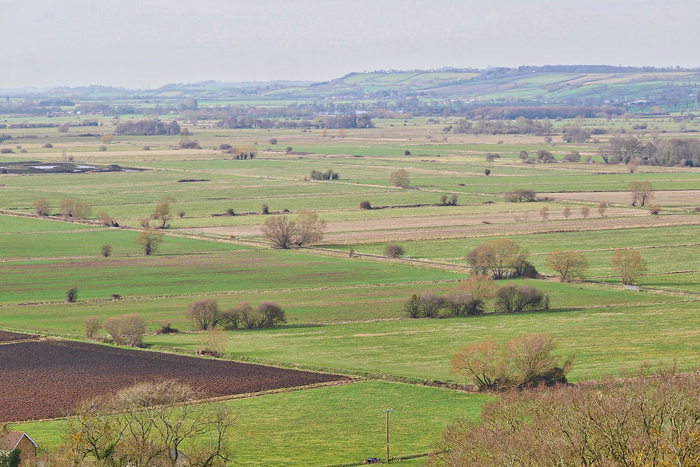
Emerging off Junction 24 of the M5 leads into a strange, dreamy landscape of rhynes, drove roads, and endless skies: the heart of Sedgemoor. This area is dominated by Burrow Mump—a 100-foot natural green mound crowned by the roofless, mystical ruins of St Michael's Chapel.

King Alfred once hid in these impenetrable bogs from the Danes, and the views from the Mump's ruined doorways are as vast as a panorama from a hot-air balloon. After taking in the hill, this circuit follows Burrow Drove and Broad Drove across the flat meadowlands, picking up footbridges over the agricultural rhynes to cross Southlake Moor. The return trail follows the peaceful riverside path along the River Parrett straight back to Burrowbridge.

Fact File
Distance: 4 to 5 miles
Terrain: Very flat marshland droves and riverbank paths (can be overgrown or damp in wet seasons).
Recommended Map: OS Explorer 140 (Quantock Hills & Bridgwater).
Pub Stop: The King Alfred Inn, Burrowbridge — Situated right at the foot of Burrow Mump, offering hearty post-walk meals, local ales, and a warm West Country welcome.

6. Brent Knoll & The Somerset Levels
No landmark in the West Country is more unmissable than Brent Knoll - the mini-mountain that presides over the M5 corridor near Bridgwater. Rising 449 feet above the sea-level polders, this giant outcrop of clays and limestone was once an island in prehistoric seas and later served as an Iron Age hill fort and Saxon lookout post.

Starting from the elegant parish church at East Brent, a field path ascends through steep, grassy slopes to the summit. Standing on the crest feels like flying without leaving the ground: the view encompasses Glastonbury Tor, the Mendip Hills, Cheddar Gorge, the Quantocks, and the Bristol Channel. The return path drops sharply down the south-western shoulder to Manor Farm, hugging a high plateau before swinging past seven level fields back to the village.

Fact File
Distance: 3 miles
Terrain: One short, very steep ascent/descent, followed by flat meadow paths.
Recommended Map: OS Explorer 153 (Weston-super-Mare & Bream Down).
Pub Stop: The Red Cow Inn, Brent Knoll — A traditional, family-run village pub located near the foot of the knoll, offering real ales, cider, and home-cooked comfort food.

CHECK OUT OUR SOMERSET WALKS PAGE HERE
Frequently Asked Questions About Somerset Pub Walks
What is the best time of year to walk in Somerset?
Somerset walks are rewarding in all four seasons. Spring and summer bring vibrant wild orchids to Lollover Hill and coastal blooms to Exmoor. Autumn highlights the golden foliage in the Quantock combes, while clear winter days offer crisp views across the Somerset Levels—provided you finish at a cozy pub with an open log fire!
Are these circular pub walks dog-friendly?
Yes, all six routes follow public rights of way and welcome dogs. However, please keep dogs on leads when passing through livestock fields—particularly on Exmoor, the Quantocks, and the Somerset Levels, where sheep, cattle, and wild ponies graze freely.
How can I make sure the pubs are open before setting out?
While all the pubs listed in this guide are well-established and active, rural opening hours can vary seasonally or on Mondays/Tuesdays. It is always wise to click through to their linked websites above to double-check lunchtime serving hours before hitting the trail.