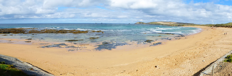
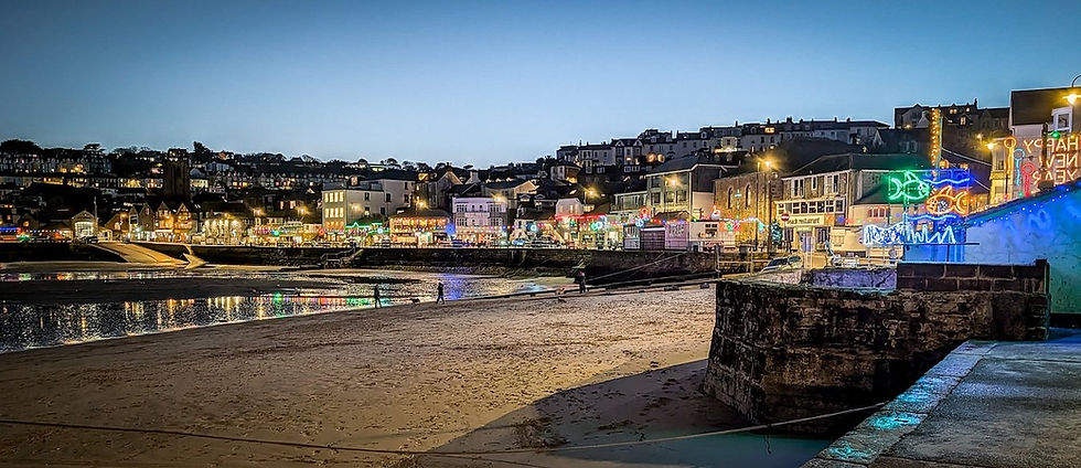
6 Great Walks Around Padstow and the North Cornwall Coast


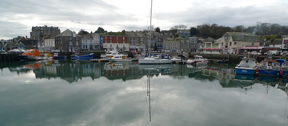
Padstow is one of the best places in North Cornwall for walking, with some superb walks around Padstow taking you from the Camel Estuary to dramatic Atlantic cliffs, sandy beaches and great headlands.
It has a beautiful harbour, a remarkable estuary, a splendid stretch of north Cornwall coast and some of the finest walking country in the West Country. Yet mention Padstow to many people and their thoughts immediately turn to restaurants, pasties and summer crowds.
I have always rather liked Padstow, despite the crowds. But what I like more than the town itself is the scenery surrounding it – the cliffs, beaches, headlands, creeks and the great sweep of the Camel Estuary.
Over the years I have walked extensively around Padstow and the nearby coast, and below are six of my favourite walks. They range from an easy stroll around the estuary to dramatic cliff-top hikes at Stepper Point, Pentire and Trevose Head.
They also take in some of the less obvious corners of this extraordinarily varied part of Cornwall.
1. Padstow to Stepper Point Circular
Some friends from up-country were complaining about Padstow to me one day, saying it was far too crowded for their liking, even on a late autumn day.
I found myself disagreeing about Padstow. I have always liked the place despite the crowds. But, thinking about it, what I like more than the town itself is the scenery of the surrounding coast and estuary.
The section of Coast Path that stretches between Roundhole Point, north of Trevone, and Stepper Point – the great bastion that protects the Camel Estuary's western approaches – offers as good a hike as you'll get anywhere along Cornwall's north coast.
No fences, no rails, no warnings; no Nanny State whatsoever out here. Just a plain, dangerous abyss waiting to swallow the unwary hiker who steps a stride or two off the beaten track.

The hike itself starts on safe terra-firma at Prideaux Place, the great Elizabethan house that rules the roost above Padstow.
A local historian in Padstow's museum once suggested that I try the "seven field walk" towards the coast. It is surprising how few people do it, and yet it makes an excellent circular hike from Padstow.
A track leads north past the grounds of Prideaux Place towards Tregirls and the estuary mouth. We will use this on the return journey, but first, after walking for about a third of a mile, take the footpath that strikes left towards the hamlet of Crugmeer.
The local historian was right. The path crosses seven fields before eventually terminating in the attractive, windswept community where we catch our first glimpse of the ocean proper.
And it is to the ocean that we go, via the track that leaves the hamlet to the left of the triangular junction at the edge of town.
When I was there the place seemed to be haunted by rooks. Great clouds of them flew about the place. It was like some scene from Hitchcock's The Birds.
The track passes Portmissen Farm before descending towards the vertical world of Porthmissen Bridge. Here we are at the cliff edge: step one step too far and you're a goner.
There is, however, a good reason for getting close to the edge – the view of Porthmissen Bridge, which is the huge hole that passes through the opposite wall of an immense gully that has bent the cliffs dramatically inland.
See our post on Great Places to Stay in North Cornwall

Once past this chasm we turn right along the Coast Path and within a few yards we are back on the safe, soft, springy downs as we leave the cliffs for a while and reach the cliffs above Longcarrow Cove.
Just past the cove there is an ideal spot for a sit-down, where the hiker is treated to a superb perpendicular view of the geological feature known as Tregudda Gorge.
Rocks the size of a church have been torn away from the Cornish motherland, revealing a great gash in their ancient, primeval bosom.
One of these rocks is called Little Merope Island and the one at the far end, looking rather like the West Country's answer to Nelson's Column, is at Gunver Head. The path then traverses north until the top of this column is just a few vertigo-inducing feet away across yet another abyss.
It must be about 200 feet high and yet the top is about as big and as flat as a kitchen table.
This is a place for gulls – as is the rest of the walk past Fox Hole, Butter Hole, Pepper Hole and Crams, until you reach the turning point under the Daymark at Stepper Point.
This is another location in which to sit and stare.
Between you and Trebetherick Point the Camel Estuary sweeps dramatically and expansively south towards Padstow – which is just about hidden from view – before veering its blue waters and pale sandbanks east on its tidal journey to Wadebridge.
Now walk south along the estuary edge, past the old coastguard cottages at Hawker's Cove and along to the big bay where you can paddle and have a snooze in the dunes.
Then strike out south again, away from the water, up across the fields to Tregirls and back to Prideaux Place.
Fact file
Basic hike: Circular route from Prideaux Place above Padstow to the Atlantic coast via Crugmeer, north along the clifftops to Stepper Point and back along the estuary.
Distance: About 6 miles.
Going: Generally easy, although the cliff sections demand care.
Map: Ordnance Survey Explorer 106 – Newquay & Padstow.
2. Padstow and Little Petherick Creek
Here's a near-perfect Cornish hike that is snookered by a little lane.
I respect the rights of ownership as much as the next man, but when a short length of private track leading along the side of a field is allowed to spoil an otherwise superb circular route, the somewhat threatening words "right to roam" come ominously to mind.

The circular route out of Padstow along the estuary side and then inland around Little Petherick Creek would make as fine an edge-of-town meander as any I know.
As I discovered when I originally walked it, however, the precise rights of way matter.
Having started your walk on Padstow's quayside, continue along the Camel Trail until you reach Oldtown Cove and the hamlet of Little Halwyn.
This is no bad thing in itself because you can enjoy fine views of the estuary every step of the way.
At Little Halwyn, turn inland and climb the road to Higher Halwyn before turning right and following the lane down towards Tregonce.
The old railway bridge over the Camel is a mighty affair, and the whole area provides a reminder that this is country shaped as much by transport and trade as by tourism.
From Tregonce, the footpath heads south-west towards the banks of Little Petherick Creek

.
The creek is an oddity. It has all the appearance of a classic Cornish creek, but is in fact the only one of its kind on the county's north coast. The other great creek systems are associated with the rias of south Cornwall.
Once on the creek-side paths you can enjoy an increasingly picturesque stroll around this secret waterway.
The path passes a place called Sea Mills, where you can see the old causeway stretching out into the creek. I was never able to discover exactly what went on here in days of yore, although it is the sort of place that immediately gets the imagination working.
And I got myself into a right old pickle here. By which I mean I collected some of the fabulously delicious samphire that grows in patches around the creek and later pickled it at home.
Little Petherick itself has an attractive creek-head setting and the church is particularly interesting.
J.R.A. Hockin, writing in Walking in Cornwall, described Little Petherick as "one of the loveliest of tree-embowered creek-head villages".
Today, inevitably, the motor car has rather more influence than it did in Hockin's day, and the narrow road bridge can make life interesting for pedestrians.
Fortunately, the moment you are back beside the creek the sound of the combustion engine is soon just a memory.
The western path is actually the Saints' Way, the ancient long-distance route that crosses Cornwall from Fowey to Padstow, and it is well laid and way-marked.
Eventually the path brings you towards St Dennis Hill, which hides Padstow from much of the surrounding countryside.
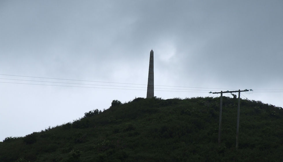
Perched on the summit is an obelisk commemorating a Victorian jubilee. You can make a short detour to visit it, or simply enjoy the view of the sweeping Camel Estuary.
Hockin described the Camel in wonderfully extravagant terms, saying it came sweeping proudly around Pencarrow to a "prolonged golden wedding with the sea".
Good stuff.
So are the names of some of the hamlets on the opposite bank of the Camel: Stoptide, Splatt, Gentle Jane and Pityme.
From here it is a pleasant stomp back into Padstow.
Important: the original route description included a section affected by a private track and rights-of-way dispute. Access arrangements can change, so check current signs and rights of way before attempting any variation of the route.
Fact file
Basic hike: Out of Padstow along the Camel Trail, inland via Lower Halwyn and around Little Petherick Creek before returning on the Saints' Way.
Distance: About 5 miles.
Going: Easy, although there are roads and some narrow sections.
Map: Ordnance Survey Explorer 106 – Newquay & Padstow.
3. Pentire Point and The Rumps
Sometimes all it takes is the merest mention. I'm talking about the all-important question of where to walk.

I first became intrigued by Pentire Point after the Cornish geologist and walks writer John Macadam mentioned that he had enjoyed a Christmas lunch picnic at the end of the celebrated point – and had even picked fresh field mushrooms there on December 25th.
This struck me as so strange that I couldn't stop thinking about Pentire.
Pentire Point, with its running mate known as The Rumps, is a two-pronged affair and makes an ideal walking country.
For a start, you get wonderful elevated views of the Camel Estuary and Padstow Bay.
Between Pentire and Stepper Point to the south-west there is nothing but current, turbulence and waves, and these three merry maidens seem to enjoy creating merry hell on the Doom Bar.
Much of this beautiful corner of North Cornwall is National Trust land.
That is significant because in 1936 the headland was divided into building plots and put up for sale. People who could not bear the idea of one of Cornwall's handsome headlands being covered in bungalows organised themselves at local and national level. They raised enough money to buy the estate and present it to the National Trust.
Check out our post on a walk from the St Moritz Hotel near Rock

I cannot even begin to imagine the nightmare that could have been.
Instead of private signs on the garden fences of ugly villas, we are free to walk the airy heaths that crown the cliff tops.
The walk starts at the National Trust car park at Pentireglaze, just north-east of New Polzeath.
Turn right out of the car park and walk along the track until you reach Pentire Farm, a hunched, weather-beaten old place where some of the buildings have slate hung around their walls to help ward off the wet and permeating winds.
Opposite the farm a footpath descends through a shallow valley towards the little bay called Pentireglaze Haven.
The path passes old gardens and follows the stream down towards the beach.
Down on the beach the cliffs are initially low eminences of slate. They grow as we begin our climb north-west towards Pentire Point.
Soon you can understand why the National Trust describes the views from here as among the most extensive in North Cornwall. The most distant headland is Trevose Head, while the daymark on nearer Stepper Point marks the entrance to the Camel.
The elevated end of Pentire Point is the sort of place where you can sit all day if you've a mind and the weather is good enough.
We didn't. It was freezing. And there wasn't a field mushroom in sight. Sensible fungi, I say.
We pressed on towards The Rumps, a sort of twin headland situated about a mile north-east.
The landscape out here is of the tortured variety. It is as if the whole peninsula was once rocked savagely by some enormous earthquake.
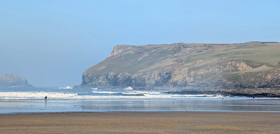
The people of the Iron Age recognised the peninsula's defensive potential and built a great fort here, complete with ramparts and ditches.
And what a civilised lot they were in their remote seaside resort. Archaeological evidence shows that they traded with people from much further afield, including the Mediterranean.
Having explored the ramparts and admired the rocky, conical island called The Mouls, we rejoined the Coast Path to head west along the cliff edge, past Com Head, to the junction of tracks above Pengirt Cove.
A turn to the right takes us across a field and back towards the car park. An excellent walk.
You certainly get a lot of everything – a lot of sea, a lot of views and more lungfuls of clean, fresh air than you might think possible in one short Cornish outing. More of everything except mushrooms.

Fact file
Basic hike: Around Pentire Point and The Rumps, starting and ending at the National Trust car park at Pentireglaze.
Distance: About 3½ miles.
Going: Easy, but watch out for vertical drops along the cliff edge.
Map: Ordnance Survey Explorer 106 – Newquay & Padstow.
4. Porthcothan to Bedruthan
There was a jangling of keys and in an instant I spotted the beast I'd driven miles to see.
Corn buntings are not immediately obvious in the great ornithological pantheon of birds. They look like fat sparrows.
Moreover, they were – in West Country terms – an endangered species when I made this walk.
I had gone to meet farmers who were being encouraged to farm in a way that helped the birds, one of them being the owner of one of my favourite campsites.
And while I was there, Ordnance Survey Explorer 106 persuaded me there was a decent chance of a circular stroll in the area that would enable me to breathe fresh air and spot small brown birds at the same time.
See our special post on some of the best beaches in Devon and Cornwall

The big golden sand beach at Porthcothan stretches inland with all the wide self-importance of a great river in its final lap of estuarine glory.
Except there is no river, just the trickles and runlets of an extremely modest stream.
At the top of the beach the stream makes a bit of a fuss with a puddle or two, but across the road its true riverine identity is revealed.
The great sandy gut that promised a river of force was made by a minnow so small that the Ordnance Survey doesn't even bother to give it a name on the map.
What it does show is a footpath following the stream's northern bank.
To find it, climb a short way up the hill leading towards Padstow and look for the track on the right. Once past Porthcothan Mill the path resumes its stream-side course all the way to the hamlet of Penrose.
I have never been to Ireland, but I'm blowed if Penrose doesn't have an Irish feel to it.
I somehow expected a local sage to issue from one of the squat cottages and lilt lyrically as a jig. But not a soul stirred in the lonely corner that somehow ended up in Cornwall instead of Connemara.
From Penrose take the road south back down into the valley and then up the other side towards Trethewell. After crossing the stream, the lane turns left and then right. At the latter corner a footpath heads across the field towards the coast, cutting a dog-leg before rejoining the road at Trevorgey.
From here you have a choice. The former route takes you towards the spectacular cliffs above Bedruthan Steps. The beach itself is currently inaccessible from the cliff top because the old steps were closed following a rockfall, but the views of the beach and its extraordinary rock stacks remain magnificent.
The National Trust owns much of the cliff-top land here and the scenery is magnificent.
On my visit, however, the August crowds were very much at large, so I chose the shorter route past Efflins to Pentire Farm.

From here the walk enters another beautiful section of National Trust country before continuing towards the coast.
I had originally come to this area partly because of the wildlife.
The cliff-top hedgerows around here have a curious feathery shrub growing along their dry-stone walls. I asked the local Countryside Manager what it was.
"Tamarisk," he told me.
It is tremendously salt-resistant and makes an excellent windbreak near the sea. The valley behind Porth Mear is one of my favourite places in Cornwall. It is peaceful and silent, and I have often seen peregrines quartering its secret crooks and crannies.
There is something almost Spanish about the valley's northern flanks – the dry-stone walls and ancient tracks accompanied by the soughing of gently bending tamarisk.
And this is where I spotted my corn bunting.
It is easy to identify once you know that its call sounds exactly like the jangling of keys.
Back at the campsite Chateau Hesp was flapping splendidly in the wind and pinned to it was a note from my wife and kids which said:
" Gone to the beach..."
Which, apart from walking, is what you go to Cornwall for.

Fact file
Basic hike: From Porthcothan Cove inland to Penrose and back via the Bedruthan area and the coast.
Distance: About 7 miles.
Going: Easy going.
Map: Ordnance Survey Explorer 106 – Newquay & Padstow.
5. St Enedoc and the St Minver Lowlands
For someone who walks in deep countryside a great deal and who chooses to live out in the middle of nowhere, I am a bit of a sucker for modernism – especially when it comes in the form of hi-tech gadgets.
But sometimes the old-fashioned way of getting somewhere is much more satisfying.
For this walk around the St Minver Lowlands I took the ferry from Padstow to Rock and pondered the Lowland appendage and the curious name Rock.

Why Rock?
What an odd name for a village built upon sand.
The walk begins at the ferry landing and heads towards the golf links.
And here we encounter one of the hazards of walking around Rock.
Golfers and walkers do not always mix well.
The public footpath crosses the golf course and, although golfers do not deliberately hurl missiles at walkers, golf balls can arrive at remarkable speed.
The ball that just missed me came hissing out of the sky like a Sidewinder missile.
"Fore!" yelled a fellow adorned in vibrantly chequered trousers.
What on earth did he mean?
Of course I do know – but can imagine there may be some golf virgins who don't.
The path eventually brings us to Brea Hill and then, mercifully, to the refuge of St Enedoc Church.
No wonder John Betjeman loved this place.
His ornately carved headstone can be seen just inside the lych gate, but the best view is from the wall at the top of the graveyard where you are treated to a vista of church, hill, dune, wood and sea.

Betjeman wrote:
"Blessed be St Enodoc, blessed be the wave,
Blessed be the springy turf, we pray, pray to thee..."
So wrote the poet in Trebetherick, which is where we go next.
It is a village on the slight hill to the north of the old church and there are various public footpaths through the area.
One of them leads down into the leafy valley near Shilla Mill.
There is something slightly creepy about the valley, although perhaps that was simply because I had been reading Betjeman.
The path eventually brings us to the sea at Polzeath, a surfing sort of place full of wet-suited folk romping to and fro from the icy waves.
Turn left and join the South West Coast Path, which takes you south past Broadagogue Cove and around Trebetherick Point to Daymer Bay.
If the tide is out, you can cut across the sands.
As you walk, you might think about the bell that rings from St Enedoc's small tower.
It came from the Italian vessel Immacolata, wrecked here in 1875, although strangely it is inscribed "Sahel".
The route continues around the coastal slopes of Brea Hill and along the low dunes towards the ferry landing.
I promise you, the acres you walk through on this walk might belong to a place called Lowlands – but they're not remotely mundane.

Fact file
Basic hike: From the ferry landing at Rock across the golf links to St Enedoc Church, then to Polzeath via Shilla Mill, returning along the Coast Path.
Distance: About 5 miles.
Going: Easy going – but watch out for golf balls.
Map: Ordnance Survey Explorer 106 – Newquay & Padstow.
6. Treyarnon Bay, Constantine Bay and Trevose Head
Constantine Bay is arguably the least Cornish place to be found anywhere along that county's wild northern seaboard.
It is more reminiscent of the Home Counties beloved by John Betjeman than anything to do with the rugged coast where that merry poet is buried.
The kind of place where you can imagine someone suburban, blue-rinse and golf-loving enjoying a holiday.

Which is strange because, having written that, I discovered that a former prime minister really did holiday here.
You won't be surprised if you've seen the posh villas and watched the silent golfing buggies plying hither and thither on the immaculate links course that dips elegantly towards the ocean.
All of which might put some people off walking here.
They might imagine gated entry and security guards dotted about the place.
But there aren't any of those things.
Instead, Constantine Bay and its little neighbour to the south at Treyarnon are jewels in the Cornish crown.
A crown topped by one of the biggest glinting things of the lot – Trevose Head and its ever-flashing lighthouse.
This walk begins at Treyarnon, where there is a sizeable car park beside the diminutive bay.
From there take the Coast Path north.
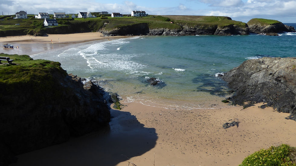
It takes only a few minutes to round the low mini-headland dividing Treyarnon from its larger neighbour, and soon you are marching across the sands of Constantine Bay.
The bay is named after a sixth-century Cornish saint called Constantine.
For now, however, our job is to walk north towards mighty Trevose Head.
There are steps at the northern corner of the bay and these lead up to the grassy downs that take us towards the headland itself.
It is a gentle slope, but it is amazing how much altitude you can gain quickly while walking on the South West Coast Path.
Towards an indentation called Mackerel Cove the going becomes tougher as the long-distance trail makes its way around a massive crater.
It is only when you dare peer into the gloomy depths of Round Hole that you realise this vast chasm has been created by the sea smashing its way in and out through a cave in the soft rock.
You can, if you wish, take a little detour around the appendage known as Dinas Head on the other side of Mackerel Cove.
Otherwise continue past the old quarries towards Trevose Head, where the lighthouse stands white and proud behind its curtain of tamarisk.
Past the elegant hedge the Coast Path takes us back inland along the northern side of the headland, passing Barras Bay and eventually the Padstow Lifeboat Station.
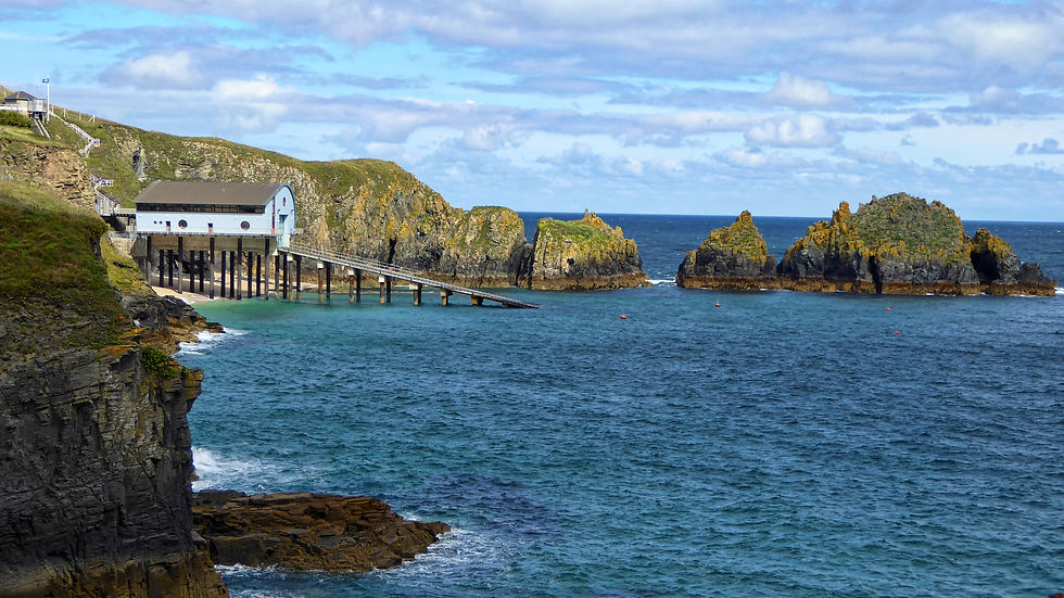
Now we are looking down into the sandy confines of Mother Ivey's Bay.
Before you ask, I know little about this mystical woman save to say that she was some kind of white witch who plied her trade hereabouts.
The Coast Path is confined to a narrow corridor as it descends behind fences around a garden and down the side of fields, eventually crossing the lifeboat station road.
There is then a slightly tricky section where we leave the Coast Path and turn inland past Trevose Farm.
In summer the narrow road can be busy, but after a few metres a pathway runs behind the low trees beside the lane.
Eventually a footpath leads across Trevose Head golf course.
This takes us across the greens towards the clubhouse and then into Constantine.
There are various ways of making your way back towards the coast. I found a small suburban road beside the community shop which took me, past the kind of villas millionaires holiday in, down towards the seaside.
Turn left and it is only a few minutes' walk back to Treyarnon.

And so I completed a truly magnificent lasso-shaped hike which was, despite my initial reservations about Constantine Bay, one of the best coastal walks I'd had all summer.
Trevose Head is also an extraordinary viewpoint.
In clear weather the view stretches virtually the whole length of the north Cornwall coast, with the prospect extending north beyond the county towards Hartland Point in Devon and south towards St Ives and Pendeen Watch.
The headland and Constantine Bay are also designated for their geological and biological interest, with important cliff habitats and breeding seabirds.
Fact file
Basic hike: Circular route from Treyarnon Bay via Constantine Bay, Trevose Head, Mother Ivey's Bay and Constantine.
Distance: About 5 miles.
Going: Generally easy, although there are some steeper sections and exposed cliff edges.
Map: Ordnance Survey Explorer 106 – Newquay & Padstow.

Padstow: there's rather more to it than restaurants
Padstow is, of course, a harbour town, and that remains one of its great attractions.
Long before it became one of Cornwall's most fashionable tourist destinations, it was a working port with fishing, shipping and boatbuilding at its heart.
The harbour itself has an unusual characteristic. Its inner basin is protected by lock gates, meaning that boats can remain afloat when the tide has gone out – a particularly striking sight on a Cornish coast where so many smaller harbours dry to mud.
The harbour also gives you a wonderful starting point for exploring the surrounding countryside.
From the quayside you can look across the Camel Estuary towards Rock and the St Minver Lowlands, while the great headlands of Stepper Point and Pentire guard the mouth of the river.
See our post on Great Places to Stay In North Cornwall With Walks

There are also reminders everywhere of the town's long maritime history.
Padstow was once a significant centre for fishing and shipping, and local historians have told me of the enormous quantities of fish once landed here. The town also had an important role in emigration, with ships carrying timber back from North America looking for cargoes for the outward journey.
And then there are the streets themselves, which have changed enormously over the decades.
I remember wandering through the Market Place and noticing three shops in a row specialising in Cornish pasties and wondering whether that wasn't really taking the pie a bit too far.

But that, perhaps, is part of Padstow's enduring appeal.
It has its touristy bits, its busy bits and its fashionable bits.
Yet walk for half an hour beyond the town and you can be among cliffs, seabirds, ancient fields, quiet creeks and enormous views across the Atlantic.
That is the Padstow I keep coming back to.
And if you want to escape the crowds, the best way I know is to put on your walking boots and head for one of these six routes.