
6 Spectacular South Devon Coastal & River Walks


I’ve gone headland happy, peninsula potty, cape crazy. I’ve become a foreland fanatic. These south-pointing headlands of South Devon are the finest jewels in our coastal crown. Stretching out into a cauldron of intense, bouncing sea-light, they stretch into the channel and make for the finest walking territory in the West Country—provided you have a decent head for heights.
Whether you are looking for wild ocean ramparts, secret smuggling coves, or serene river banks, here is a curated guide to six of the very best walks in South Devon, complete with my favourite open-for-business local pubs to reward your efforts.
💡 Planning a South Devon Walking Break?
These 6 hikes are best explored from basecamps in Salcombe, Dartmouth, or Bigbury-on-Sea.
1. Hallsands to Start Point
Distance: 4 miles | Going: Easy to moderate (dramatic cliff drops)

Oddly enough, given all the joy and light of South Devon’s coast, our first route begins at a place that is both melancholic and forlorn. The lost village of Hallsands is probably one of the West Country's saddest sights. It was doomed by the actions of man—a gigantic dredging operation to supply gravel for Devonport Naval Dockyard caused 37 houses to slip into the sea when the beach level dropped four meters. The final catastrophe came in January 1917, when a fierce storm destroyed the remaining community. One little-known tale from Hallsands is that locals kept trained Newfoundland dogs, who would swim out beyond the crashing breakers to fetch boat ropes in their teeth.
From the viewing platform overlooking the ruined cottages, the South West Coast Path begins a gentle ascent along bracken-covered hillsides toward Start Point. Whichever way you turn, the vistas are stunning. Looking back, Devon’s coast marches north past Beesands and the great blonde thread of Slapton Sands toward Dartmouth. To the south, Start Point stabs the Channel like a serrated dagger.
IF YOU'RE ENJOYING THIS POST CHECK OUT OUR DEVON WALKS PAGE HERE
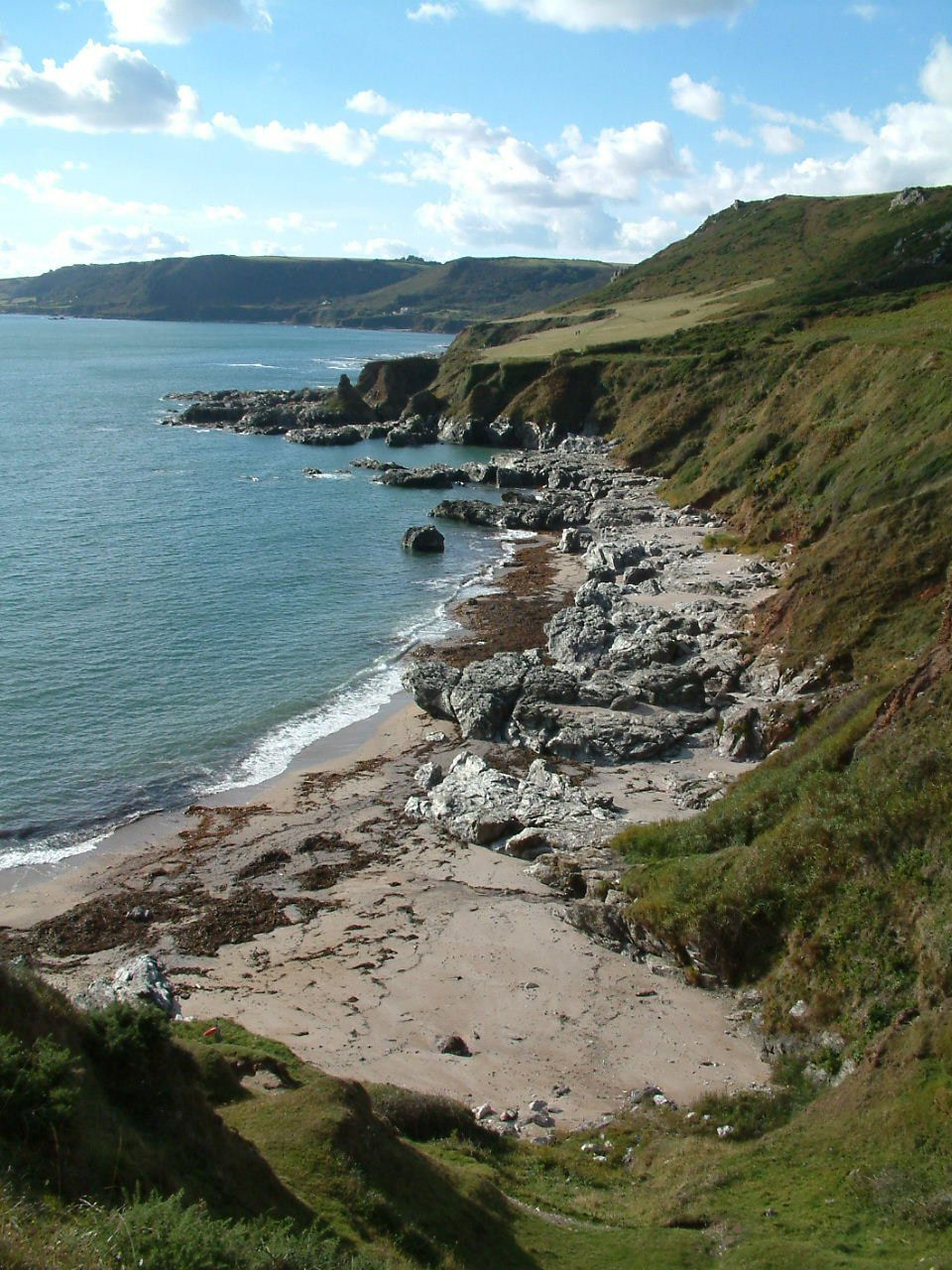
Following the Trinity House lane past vertiginous slopes, you reach the dramatic 1836 lighthouse. This point has historically been a killing ground for shipping—in March 1891 alone, six vessels came to grief here in just 30 days due to the lethal tide-race. Returning via the aerial path above The Warren and Great Mattiscombe Sand, this lasso-shaped hike delivers an unbeatable dose of winter-curing coastal light.
🍻 Nearby Open Pubs
The Cricket Inn (Beesands) – Situated right on the sea wall, famous for locally caught seafood and fine ales.
The Tradesman’s Arms (Stokenham) – A classic 14th-century thatched pub just inland, serving superb traditional pub food.

2. Thurlestone to Hope Cove
Distance: 4 to 5 miles | Going: Easy to moderate
South Devon’s coast is great for facing south, but hardly any of it faces west. There are times of a late afternoon when I fancy a bit of westerly walking—you get to watch the sun go down over the sea and get drowned in the very last ounce of light available in these isles. Which is why I removed myself to Thurlestone.

Central Thurlestone is old and grand, dominated by a handsome church whose ancient annals record that in 1328 the Bishop of Exeter threatened to excommunicate the parish because locals refused to pay the Abbot of Buckfast's fees to cleanse the building after blood was spilled inside. Heading south down past the golf course, you join the South West Coast Path.
It’s an odd bit of littoral—a little bit of Wiltshire-by-Sea with scruffy beaches and stunted cliffs. Yet, it holds a wonderful eerie quality. Off the strand sits the famous Thurlestone Rock, pierced by a giant hole through its middle that moans like crying Sirens when the wind blasts through. Local legend speaks of a passenger named Ms. Burke who survived a 1772 shipwreck here laden with jewels, only to be murdered on the sand by three local wreckers—all of whom later met untimely, cursed ends.

Hitchcockian darkness defied, the trail climbs wide downs echoing with skylarks before descending into the sunlit resort of Hope Cove. It is a glorious stretch that lets you witness the sun dipping out over Bigbury Bay before returning via inland paths past South Huish.
🍻 Nearby Open Pubs
The Hope & Anchor (Hope Cove) – A welcoming coastal pub nestled right by the harbor slipway.
The Cottage Hotel Bar & Terrace (Hope Cove) – Offers elevated, sweeping views across the bay for a evening drink.
CHECK OUT OUR SPEICAL SOUTH WEST COAST PATH PAGE HERE
3. East Prawle to Gammon Head
Distance: 3.5 miles | Going: Easy going
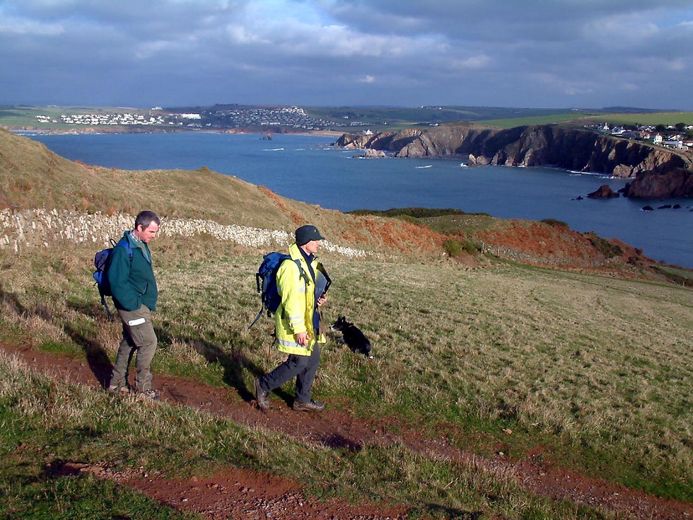
"From Start to the entrance of Salcombe harbour the coast is of such a wild beauty that all who persist in talking about the gentle charms of South Devon should be marooned there for a week in winter." So wrote author S.H. Burton half a century ago, and not an inch of this craggy chunk of coast has changed since. It is Devon’s best-kept secret—rugged, ocean-ravaged ramparts more reminiscent of far-flung Cornwall.

No one goes to East Prawle, Devon’s most southerly village, unless they want to. Setting out from the green, narrow lanes purple with violets head south toward Pig’s Nose, Ham Stone, and Gammon Head. Smugglers of yore stomped up and down these ancient tracks laden with contraband, especially near Black Cove where two Spanish galleons once smashed onto the rocks (doubloons have been found on the beaches in recent times).

The ancient track gives way to steep fields that drop down to the rugged shoreline. Joining the coast path near Elender Cove, you climb back up toward Sharpers Head, where the village lights twinkle invitingly on the ridge above. It proves that a long journey down narrow lanes is a small price to pay for such an unblemished scenic treat.
🍻 Nearby Open Pubs
The Pig’s Nose Inn (East Prawle) – olne of my favourite pubs in the world! Devon’s most wonderfully eccentric, historic village pub, packed with character, memorabilia, and great local beers.

🗺️ Open Interactive South Devon Stay Map
4. Greenway to Kingswear (The River Dart Trail)
Distance: 5 miles | Going: Moderate (can be muddy in places)
This isn't so much a walk, more a grand day out along four or five of the most scenic riverside miles in the West Country. The National Trust is conscious of traffic in the narrow lanes around Greenway - Agatha Christie’s old home on the River Dart - making the journey there half the fun via steam train and ferry.

The walk follows a prime section of the 16-mile Dart Valley Trail. Leaving Greenway, the lane climbs toward Maypool before heading up a track over Oakham Hill. At the crest, you are treated to fantastic panoramas over the great bend in the river north of Dittisham, stretching all the way past Bow Creek to the outskirts of Totnes.
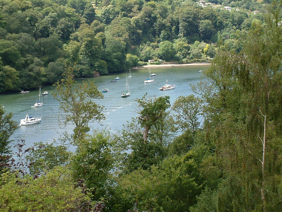
Crossing the ridge, the main body of the Dart opens up below as it heads toward the sea. The path enters Long Wood—a 100-acre semi-natural ancient oak canopy owned by the National Trust. Don't be shocked if you suddenly hear a steam whistle echoing through the trees; the trail weaves close to the Greenway railway tunnel, and the sudden emergence of a massive steam locomotive is a frightening and wonderful thing to behold.
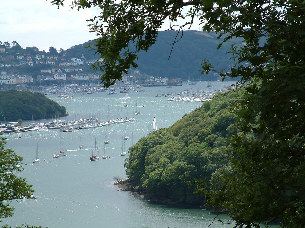
Following the path through the woods above bustling marinas, you descend into Kingswear, finishing opposite Dartmouth’s historic waterfront.
🍻 Nearby Open Pubs
The Ship Inn (Kingswear) – Positioned right on the river foreshore with exceptional views across to Dartmouth.
The Steam Packet Inn (Kingswear) – Famous for fresh food and local ciders, located just yards from the steam railway terminus.
5. East Portlemouth & Gara Rock Circular
Distance: 4 miles | Going: Easy going
Even on the darkest winter days, a small open ferry plies back and forth across Salcombe Harbour, depositing walkers in the parish of East Portlemouth. Leaving the town quay behind, you step off into a coastal sanctuary that feels miles away from high-street bustle.
A small lane weaves above the shoreline past Mill Bay—one of the most pleasant sandy coves within a few hundred yards of any town—before leading through woods around Biddlehead Point to Sunny Cove. Here, the coast path stretches out over Rickham Common toward Limebury Point, where trawlers line up to cross the treacherous Salcombe Bar under the massive cliffs of Bolt Head.

During WWII, Bolt Head hosted a cliff-edge aerodrome. Local history recalls Lancaster bombers barely clearing the drop with engines screaming as they fought for height over the waves, and lost pilots searching the fog for the legendary "hole in the sky" above Salcombe.
The trail climbs up and down along Portlemouth Down in true Coast Path tradition, leading to the thatched lookout tower at Gara Rock. After taking in the wide open sea views, the route turns inland, descending through pretty woodland shaded by strangely shaped ancient lime trees back to the ferry slipway.

🍻 Nearby Open Pubs
Gara Rock Kitchen & Bar (Gara Rock) – Perched high on the cliff-tops, offering incredible ocean dining and mid-walk refreshments.
The Millbrook Inn (South Pool) – Located a short drive up the creek, world-renowned for its organic local food and village pub charm.
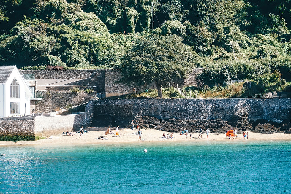
6. Bigbury & Ringmore via Ayrmer Cove
Distance: 4 miles | Going: Moderate (one steep climb)
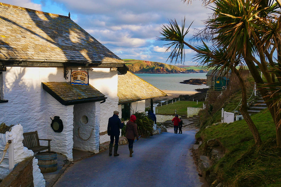
Here is a South Devon walk that takes you far from the madding bucket-and-spade crowds. But first, no visit to Bigbury would be complete without a quick hop across the causeway to Burgh Island. Reachable on foot at low tide or via the famous sea-tractor, this magical isle is home to the ancient Pilchard Inn, where 18th-century wreckers and smugglers like Tom Crocker once operated (his ghost is still said to haunt the doorway).

Back on the mainland, pass around Warren Point into Challaborough Bay before tackling the steep flanks of Toby’s Point. Here, an inland path leads to the quiet village of Ringmore. It's a stretch of track where sun-basking lizards and adders lounger along the old stone walls.
In Ringmore, the 13th-century Journey’s End pub hides secret rooms once used to store contraband. From the village, you can descend the enigmatic, leafy Smuggler's Path down to the secluded sands of Ayrmer Cove.

The return leg requires a steep climb back over the headland, where wild flowers carpet the slopes and panoramic views of the whole of Bigbury Bay stretch out before you, guiding you safely back to Bigbury-on-Sea.
🍻 Nearby Open Pubs
The Journey’s End Inn (Ringmore) – A historic 13th-century thatched pub hidden in a quiet valley, serving outstanding food.
The Pilchard Inn (Burgh Island) – A 700-year-old hideaway right on the water's edge, welcoming mariners and walkers since 1336.
💡 Planning a South Devon Walking Break?
We’ve set up a custom map showing live availability for coastal cottages, pubs, and B&Bs across the South Hams:
Frequently Asked Questions (FAQ)
What is the best time of year to walk the South Devon Coast Path?
While summer offers long days and warm sea breezes, autumn and bright winter days are arguably the best times for coastal headlands like Start Point and Prawle Point. The low sun creates an extraordinary, intense light bouncing off the water from three sides, and the trails and pubs are far quieter than during peak summer months.
Are these South Devon walks suitable for beginners or children?
Most of the hikes featured—such as Thurlestone to Hope Cove or the Greenway river trail—are moderate and easy going underfoot. However, certain coastal headland sections, particularly around Start Point and Gammon Head, feature narrow paths along vertiginous slopes with sheer cliff drops where extra caution and a good head for heights are required.
Can I reach these walks using public transport?
Some routes offer fantastic public transport links—most notably the Greenway to Kingswear walk, which can be combined with the Dartmouth passenger ferry and the Paignton and Dartmouth Steam Railway. Other headland routes, like East Prawle, are located down remote country lanes where driving or local taxis are the most practical options.
Are dog-friendly pubs available along these walking routes?
Yes, South Devon is exceptionally welcoming to walkers with dogs. Most traditional inns along these routes—including The Pig’s Nose Inn at East Prawle, The Cricket Inn at Beesands, and The Journey’s End Inn at Ringmore—happily welcome dogs in their bar areas and gardens.
Where is the best basecamp to stay for a South Devon walking weekend?
Salcombe, Hope Cove, and Kingswear/Dartmouth make the three best basecamps. Salcombe and Hope Cove provide quick access to the southerly coastal headlands, while Dartmouth offers easy access to the River Dart estuary trails and steam railway connections.


