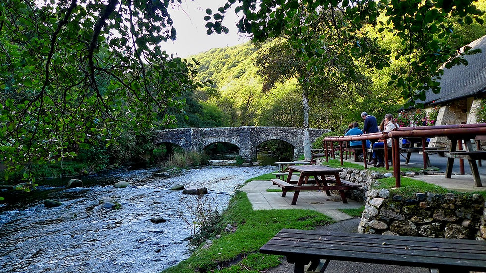
5 Unmissable Devon Walks: From Dartmoor Tors to the Jurassic Coast


Devon offers an entirely different walking environment than almost anywhere else in the West Country. Whether you are scrambling up steep red-sandstone coombes, navigating ancient smuggler tracks, or strolling beneath dark forest canopies, here are five of my favourite walks across the county.
CHECK OUT OUR DEVON WALKS PAGE BY CLICKING HERE
1. Ashclyst Forest — Central Devon
From our earliest age we are made aware of big dark forests – they are fairytale places where big bad wolves live and where we humans get horribly lost. Novice hikers might be tempted to take a bag full of white pebbles with them, like Hansel and Gretel.

Far be it from us to suggest readers deposit any kind of object into one of our environmentally immaculate forests. Instead, let’s go to Ashclyst Forest – one of the largest tracts of ancient woodland in the region – situated not in the back end of ancient beyond but just a short witch’s broom-ride from the M5. It is rich in waymarked walks and it should be impossible to get lost.
Ashclyst is not only easy to reach, but hugely enjoyable - having been well preserved by its owner the National Trust. There are several car parks but the main one, situated at OS grid ref SY 001995, has an interpretation board showing the various way-marked trails which vary from 1.5 miles to a total of seven miles in length.
The board also gives a brief potted history of the forest, which is interesting because you get the distinct feeling that up here - out of earshot of the modern world - this is how much of England used to be.
We recommend the Trust’s Butterfly Walk - a leisurely stroll along sunken lanes and woodland rides and through broad-leaved and coniferous woodland, good for fritillary butterflies, white admiral and other butterflies. It can be a bit muddy in winter on this clay ground - for directions see the interpretation board or visit the National Trust Killerton website.
Distance: 4 miles
Time: 3.5 hours
Difficulty: 6/10 (when wet)
Image Alt Text: Sunlight filtering through ancient trees on the Butterfly Walk in Ashclyst Forest Devon
2. Branscombe West — East Devon Coast
Branscombe is one of the most beautiful villages to be found in East Devon. Tucked away in its own valley, you wouldn’t think there was a village in the area at all if you were viewing the coast from out at sea. Which is probably the reason why, centuries ago, Branscombe became a busy centre for smuggling.

One of the best basic hikes you can do in the area is from Branscombe Mouth west on the coast path to Weston Mouth and back along the beach. It’s advisable to check the tides first, and be warned: walking along the shingle on the return leg is heavy going.
So is the beginning of this walk. Climbing the Alpine-like slope that stretches up from the seaside car park at Branscombe is a puff. It is a slope of the house-roof variety.
Only when you get to the top do you realise that the southerly hill which protects the village of Branscombe is, in fact, one of those sham eminences - a bit like a street frontage on a movie set. The slope ascends steeply up through the beech hanger from the village - and then ends abruptly in a sea-facing abyss.
The South West Coast Path follows this ridge as it threads its way west, past various old quarries, towards a place called Berry Camp. As you stroll along here you can see the curious geographical layout and begin to realise why Branscombe became one of the smuggling capitals of the south coast.

What looks like a remote and isolated stretch of coast is in fact just a few hundred yards (as the seagull flies) from the village which is hidden and protected by this curiously positioned ridge. Most coastal hills in the region follow river valleys from inland as the stream flows towards the sea - this one runs directly parallel with the coast and so hides the valley behind it.
Eventually the path takes you down to Weston Mouth. Much of the territory covered on the route is, by-the-way, owned by the National Trust - including this latter chunk down the steep contours into Weston Combe.
If the tide is out you can head back along the beach. It's a bit of a trek, made all the more arduous by the fact the shingle is of the small and rolling variety. The actual distance is about two miles, but it feels more like five by the time you get back to Branscombe Mouth.
Distance: 4 miles
Time: 3.5 hours
Difficulty: 6/10
Image Alt Text: Looking down at Branscombe Mouth and the steep coastal ridge on the East Devon coast path
CHECK OUT OUR SOUTH WEST COAST PATH WALKS PAGE BY CLICKING HERE

3. Heddon’s Mouth to Woody Bay Circular — Exmoor Coast
This walk always features in my Top Ten of Wonderful West Country Walks.
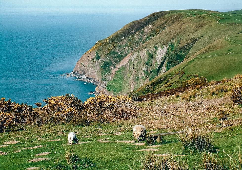
The perpendicular plod which meanders from Heddon's Mouth to Woody Bay and back again would certainly be up there among the best-sellers. It boasts views by the vista-load, history by the ancient, dusty, book-full and enough solitude to wither a lonesome pine.

The first part of this hike is down Heddon's Mouth Cleave - which really is one of the steepest, deepest valleys to be found anywhere in the West Country. It runs straight out of the depths of Exmoor down to the sea, and the fact that there's an excellent hostelry deep at the bottom of the great gulch is almost thrown into insignificance by the grandeur of it all.
You can park near the pub in the small car park opposite the National Trust visitor centre which will tell you all about the remarkable terrain. Then, walk past the inn (you will need refreshment on your return) and follow the road around the bottom of the valley towards Trentishoe. After a quarter of a mile you will see the footpath leading to the beach on your right.
It's a riverside mile down to the sea - one of the most dramatic miles in England. In 1827 a local farmer called Jim Hoyle was caught with no fewer than £1,180's worth of brandy hidden under his stable floors. Customs and Excise confiscated the 262 tubs of booze, but lucky Jim escaped through a back window.
And now we cross the river to find the coast path which heads in an easterly direction - albeit vertically - out of the valley and along the coast on a section of the right of way which is not for those who suffer vertigo. Eventually there's a climb through the woods towards the upper section of the scattered community of Woody Bay.

Many of the paths around here were put in place by James Hannington, a local curate, and after that an African bishop - who found himself 'rusticated' from Oxford and forced to learn the duties of his calling at nearby Martinhoe. You'll see this rugged little hamlet across a few fields later, but you won't see poor old Hannington who was eventually done to death by irreligious natives deep in the Dark Continent.
Eventually we reach the old carriageway near Woody Bay, where we turn right back towards Heddon's Mouth to enjoy the breathtaking views that sweep across the Bristol Channel.
The dramatic headlands which punctuate Exmoor's vertical coast fall over themselves in a queue as they enthusiastically line up to show just who's best at being jagged and dangerous. There's Crock Point, Duty Point, Hollerday Hill above Lynton and Lynmouth and, of course the North Devon Foreland with its lighthouse blinking intermittently above the grey sea.

Along the way we pass the remains of the Roman signal-station in which Italian soldiers must have once frozen on guard-duty. After that the track turns into the massive Cleave and takes you dramatically back to Hunter's Inn.
Distance: 6 miles
Time: 4 hours
Difficulty: 6/10
4. Bonehill Down and Honeybag Tor — Dartmoor
We chose the walk over Bell Tor, Chinkwell Tor and around Honeybag Tor because it is surrounded by features which, even in a thick fog, should see you safely back to your car. Which sounds a bit dramatic, but this meteorological shutdown is not unknown on the heights of Dartmoor.

We parked at Hemsworthy Gate, on the junction of the Haytor and Ashburton roads as they join in their bid to reach Widecombe, so that we could take the gentle stroll up to Top Tor and enjoy the rolling, unfoggy, views which stretch right across the South Hams.
From Top Tor we walked due north, descending to cross the Widecombe road and reach Bonehill Rocks. This is as splendid a knot of granite as you’ll find anywhere on the moors and is very popular, given the close vicinity of several small car parks.

Here we are on the big north-south ridge which rises to the east of Widecombe and which guards its moorland vale from the higher land of Dartmoor’s main south-easterly bastion, centred on Haytor.
From Bonehill Rocks we descended to the north west (crossing the Bonehill lane) and, avoiding a bog, climbed Bell Tor. From there it was north-west again to Chinkwell Tor. Here you get a fantastic aerial view that allows you to look straight down the valley where the East Weburn River is making its way south to join its sister stream.

From Chinkwell Tor, it’s north again down over the saddle and up to Honeybag Tor, which marks the end of the ridge. You have a number of options for the return route. We retraced our steps down to the dip of the saddle where a big man-made rut slices the hill.
A green path runs west down the edge of the rut into the vale, and this we followed until we gained the woodlands that fringe the North Bovey lane. Here, on the upper edge of the woods, a broad stone track follows the contours south under Chinkwell Tor, eventually climbing above the fields to regain Bonehill Down.
Now we continued due south along the contours, re-crossing the main Widecombe-Haytor road to reach the Shovel Stone. Then it’s a matter of following a southerly arc around Top Tor - taking in Hollow Tor, Pil Tor and Foale’s Arrishes – before eventually returning to your vehicle. The two hour walk will give you some of the best views on Dartmoor.
Distance: 4.5 miles
Time: 3 hours
Difficulty: 4/10

5. Otterton River and Coast — East Devon
This is one of the region’s truly classic circular hiking routes. There's a serene and beautiful river, an estuary teeming with bird-life, terracotta coloured sea-cliffs affording panoramic views of the South Coast and a picture-perfect English village just to round things off.

The circular walk that takes you down river from Otterton to the sea at Budleigh Salterton and then north-east along the coast to Ladram Bay, before returning across the hill, is as consummate a perambulation as any you'll find on our well endowed peninsula.

The village of Otterton would win plenty of points in a Comely Communities of England Contest but, as you'll be seeing more of the place later, turn your back on the delights of its pretty main-street and cross the river to find the footpath which follows the Otter as it heads south through a series of classic water-meadows on its way to the sea.
Eventually we cross the little bridge which leads to South Farm, and see how the waterway - which spoke of Tales By the Riverbank and Ratty and Moley and Toad - suddenly manages to transform itself into something marine, salty and wild.

Now we walk down the east side of the estuary along a path which takes us just above a copse. Beyond this are excellent views of the saltings and the sea which can be enjoyed from the bird-hide.
Now we are on the coast path section which climbs the cliff edges east past Danger Point, Black Head, Brandy Head, Crab Ledge and Chiselbury Bay. You can see the red cliffs stretching east to Sidmouth, beyond which they stop abruptly to allow the chalk to take over.
The path does a gentle roller-coaster number along the very edge of the fields, and always in front of you is High Peak. It has the biggest red cliffs of all and towers above the great curve of the coast with its Alpine look-alike peak covered in conifers.
Between you and it is Ladram Bay with its attractive shingle beach, its big bold rock stacks and its holiday camp. We can avoid the latter by following the bridleway up past Monks Wall and from there it was a short walk over the hill back down into Otterton.
Distance: 6 miles
Time: 3 hours
Difficulty: 5/10
Image Alt Text: The River Otter estuary winding past water meadows toward the sea near Otterton East Devon

Frequently Asked Questions About Walking in Devon
What should I wear or pack for walking on Dartmoor and the Exmoor Coast?
The Westcountry weather can turn from blistering sunshine to a dense maritime shutdown in a matter of minutes. Even on shorter rambles like Bonehill Down or Heddon's Mouth, always pack a dependable windproof waterproof layer, sturdy ankle-supporting boots for rugged granite paths and rolling shingle, and plenty of water. If you are venturing up onto the high moor, taking a proper Ordnance Survey paper map alongside your phone is always wise.
Are these Devon walks suitable for dogs?
Yes, all five routes are wonderful for four-legged companions, but sensible precautions are essential. On coastal routes like Branscombe West and Heddon's Mouth, keep dogs strictly on leads near steep cliff edges and unfenced drops. On Dartmoor and Exmoor, keep them under close control around grazing ponies, sheep, and ground-nesting birds.
When is the best time of year to do these walks?
Every season brings its own magic to Devon. Spring and early summer bring spectacular displays of wildflowers, sea pinks along the cliffs, and fritillary butterflies in Ashclyst Forest. Autumn turns the river valleys and ancient woodlands into rich golden canopy walks, while winter offers crisp, dramatic coastal views—though you should expect muddy tracks underfoot in clay areas.
Where can I park and find refreshments along these routes?
All five walks feature convenient parking at or near the start, and each route passes or finishes near an excellent West Country hostelry or traditional tearoom. Whether it's a well-earned pint at the Hunters Inn after tackling Heddon's Mouth, or a local pit-stop in Otterton village, you won't be far from good food and drink.