
Cornish Walks: Around St Anthony Head, Cornwall

Updated: Sep 5
Embrace the beauty of Cornwall on this circular walk featuring stunning views and abundant wildlife

Introduction to St Anthony Head Walk, Cornwall
St Anthony Head is one of those Cornish places where a relatively modest walk manages to pack an extraordinary amount into a few miles. Sitting on the tip of the Roseland Peninsula opposite Falmouth, it gives you big views across Carrick Roads and out towards the open sea, but there is much more to discover than simply the coastline.

This circular walk takes in Towan Beach, Porthbeor Beach and Zone Point, before reaching the headland itself, with its old gun emplacements and lighthouse. From there the character of the walk changes as the route turns towards the quieter waters of the Percuil River, passing Great Molunan, Place House and a succession of small coves and creeks.
It is an easy-going walk in terms of steep climbs, although the path beside the Percuil can be distinctly muddy after wet weather. What makes it particularly enjoyable is the variety: beaches, woodland, military history, wildlife, sheltered creeks and some magnificent views across one of Cornwall's most beautiful stretches of water.
I first walked this route when I was looking for a way of exploring St Anthony Head and the surrounding Roseland coast without simply retracing the same stretch of shoreline. It proved to be a far more varied walk than I had expected — and one that rewards taking your time rather than rushing around the headland.
Getting to St Anthony Head
St Anthony Head lies on the Roseland Peninsula, on the opposite side of the Fal estuary from Falmouth. Getting there involves following some narrow Cornish lanes to the National Trust car park at Porth Farm, close to Porth Creek.
In summer there is another possibility: you can cross the water on the small ferry from St Mawes, turning the walk into part of a much bigger day out on the Roseland.
I would use the Porth Farm car park as the starting point for this walk.

Starting the Walk at Towan Beach
From Porth Farm, cross the lane and take the footpath towards Towan Beach.
This is an enjoyable beginning to the walk because you are almost immediately into the countryside and beside the coast. Keep an eye on the rocks around Killigerran Head, where seals can sometimes be seen.
From here the route continues along the coast towards Porthbeor Beach.

Porthbeor Beach and Zone Point
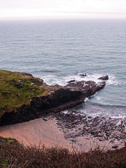
Porthbeor Beach is one of those small Cornish beaches that can easily make you stop for a while. Golden sand, rocks and the surrounding cliffs give it a wonderfully secluded feel.
Continue around Zone Point and the character of the walk begins to change as St Anthony Head comes into view.
This is where the scenery starts to open up dramatically, with views across the water towards Falmouth and the Helford area.

St Anthony Head and its Military History
St Anthony Head is much more than a good viewpoint.
The headland was an important part of the coastal defences protecting Falmouth and its harbour, and the old gun emplacements remain as a reminder of its military past.
It is worth taking a little time to explore this part of the headland rather than simply walking past it. The interpretation board explains how the defences operated and why this particular position was so important.
The views are impressive, too, stretching across Carrick Roads towards Falmouth and along the Cornish coast.

The Lighthouse and Great Molunan
From St Anthony Head, descend towards the lighthouse and continue along the coast.
The route passes two sandy coves before reaching the old pine stand at Great Molunan.
This is another lovely section of the walk, with the landscape becoming quieter and more sheltered. It is a good place to pause and simply take in the surroundings before continuing towards the Percuil.


Views Towards St Mawes and Place House
As the path leaves the immediate shoreline and crosses a small rise, you get a fine view across towards St Mawes.
The route then brings you to Place House, the neo-Gothic manor built in 1840 by Sir Samuel Spry on the site of a former monastery.
Nearby is Place Quay, while the old church is another reminder of the long history of this little corner of the Roseland Peninsula.
This is one of the things I like about the walk: within a relatively short distance you have moved from open sea and military history to creeks, old buildings and the much more sheltered landscape around the Percuil.


The Muddy Path Beside the Percuil River
This is the section where you need to take a little more care.
The path heads northeast along the shore of the Percuil River towards North-hill Point and Porth Creek. After wet weather it can become muddy, slippery and rather awkward in places, with the path zigzagging close to the water.
It isn't particularly difficult, but proper walking shoes or boots are a good idea, especially after rain.
The compensation is the scenery. The Percuil is a wonderfully peaceful stretch of water, and this quieter section provides a complete contrast to the exposed headland earlier in the walk.
Eventually the path brings you back towards Porth Creek and the end of the circuit.

A Walk with a Bit of Everything
What makes this St Anthony Head walk particularly enjoyable is the variety packed into it.
You have beaches and open coastline, spectacular estuary views, an old military battery, a lighthouse, woodland, creeks, historic buildings and the possibility of seeing wildlife along the way.
It also gives you a chance to see a less familiar side of the Roseland Peninsula. St Mawes and the more obvious tourist destinations may attract much of the attention, but the countryside around St Anthony Head rewards anyone prepared to explore a little further.
If the weather is good, allow yourself plenty of time. This isn't a walk I'd recommend rushing.


Walk Fact File
Walk: St Anthony Head circular walk, Roseland Peninsula, Cornwall
Starting point: National Trust car park at Porth Farm
Map: Ordnance Survey Explorer 105 – Falmouth & Mevagissey
Terrain: Mostly straightforward coastal paths, with some muddy sections
Difficulty: Moderate/easy-going, with no major climbs
Main attractions: Towan Beach, Porthbeor Beach, Zone Point, St Anthony Head, gun emplacements, lighthouse, Great Molunan, Place House and the Percuil River
Footwear: Walking shoes or boots recommended, particularly after wet weather
Food and drink: Porthscatho provides the nearest options; in summer the ferry can also take you across to St Mawes.

Frequently Asked Questions
Where does the St Anthony Head walk start?
The walk starts at the National Trust car park at Porth Farm, near Porth Creek on the Roseland Peninsula.
Is the St Anthony Head walk difficult?
It is generally an easy-going walk without major climbs, although some sections can become muddy and slippery, particularly alongside the Percuil River.
Can you see Falmouth from St Anthony Head?
Yes. St Anthony Head has excellent views across Carrick Roads towards Falmouth.
Is there a lighthouse at St Anthony Head?
Yes. The lighthouse stands on the headland and forms one of the highlights of the walk.
Can you get to St Anthony Head by ferry?
During the summer months, a small ferry operates between St Mawes and the Roseland side of the Fal, providing an alternative way of incorporating St Anthony Head into a day out.


