
Heddon's Mouth and Woody Bay: A Classic Exmoor Coast Walk

Friends who come to stay often bully me into naming my favourite West Country walks. After so many years of writing about them that's not easy – countless fabulous routes riddle the peninsula – but this one is always near the top of the list. Indeed, when a television company asked me to shoot a pilot for a series of walks programmes, this was the hike I chose.

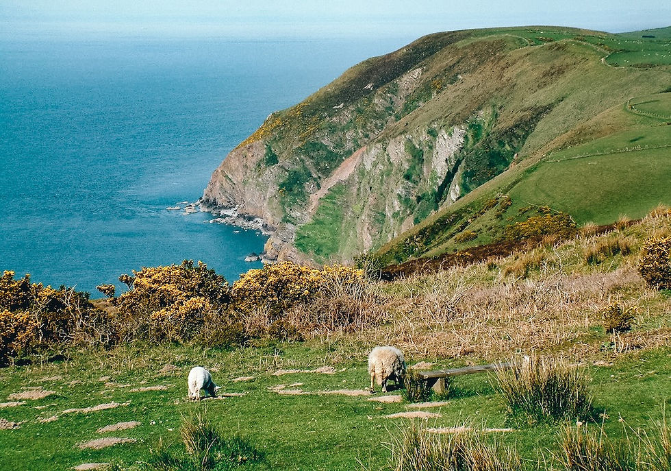
It's a five-mile loop from Woody Bay along an old Victorian carriageway high above the sea, down into the great cleft of Heddon's Mouth, and back along the coast path proper – one of the most dramatic stretches of coastline in England.
Getting to Woody Bay
Getting to the little roadside car park just west of Woody Bay can be an adventure in itself if you drive along the narrow toll road from Lynton. Once through the dramatic Valley of Rocks, the road comes as close to the edge of 400-foot cliffs as you'll ever want to be on four wheels. But, having arrived safely, it's easy to find the wide carriageway that heads west on the first half of the walk.
Along the carriageway above Wringapeak
The dramatic headlands that punctuate this vertical coast fall over themselves in a queue to show who's best at being jagged and dangerous. There's Crock Point, Duty Point, Hollerday Hill above Lynton and Lynmouth, and the North Devon Foreland with its lighthouse blinking above the grey sea. And far below your untroubled boots there is Wringapeak.
Strange, lonely and just about inaccessible, this humble tooth of a headland is forever swathed in a white cloud of gulls and kittiwakes. In the unwelcoming depths beneath lives the "Gurt Fish of Wringapeak", which has been striking the fear of God into locals for centuries.

Even brave James Hannington wouldn't swim down there. He was the boisterous young fellow who was sent down from Oxford for a spell and later served as a curate at nearby Martinhoe, whose hamlet you'll see nestling a few fields south of the carriageway. Hannington loved this vertiginous landscape so much that he cut a myriad of dizzying paths along the cliffs – many of them have since been tipped into the sea by landslides. He went on to become a bishop in East Africa, where he was killed in 1885, in what is now Uganda.
Just before the carriageway turns the corner towards Hunter's Inn, it passes the site of a Roman fortlet, where soldiers once kept a lonely watch over the Bristol Channel – and must have felt every bit as homesick as Hannington did in Africa.
Down Heddon's Mouth Cleave to the sea
Now we're into Heddon's Mouth Cleave, one of the steepest, deepest valleys to be found anywhere in the region. It runs straight out of the depths of Exmoor down to the sea, and the fact that there's a hostelry at the bottom of the carriageway – the Hunter's Inn – is almost thrown into insignificance by the grandeur of it all.

After a pint at the Hunter's Inn, take the path beside the river that leads down to the sea at Heddon's Mouth itself, with its pebble beach and old lime kiln. It's a riverside mile down to the sea – one of the most dramatic miles in England.
Smugglers and U-boats at Heddon's Mouth
On the beach here I once told the TV camera a remarkable story I uncovered some years back: that during the Second World War a Nazi U-boat crew, desperate for fresh water, landed here and, while their tanks were filling from the stream, had the temerity to play a game of football. "Where were Dad's Army?" is the question I always ask.
As for smugglers, in 1827 a local farmer called Jim Hoyle was caught with no fewer than 262 tubs of brandy hidden under his stable floors – worth £1,180 at the time. Customs and Excise confiscated the lot, but something within me is glad to report that lucky Jim escaped through a back window.
Back to Woody Bay along the coast path
Now it's back to Woody Bay, but this time along the lower path. You'll see it climbing the eastern flank of the valley. Be warned: those with weak heads for heights might prefer to consult the map and find their own way back through Martinhoe.
This lower track is the South West Coast Path proper, and there are bits of it that lead close to the abyss. But it's well worthwhile. You might see a peregrine quartering the slopes – I've spotted both a peregrine and a hen harrier out here, not to mention countless seabirds winging in and out of their cliffside colonies far below.
Eventually there's a climb through the woods back to the car, but not before you've crossed just above Wringapeak, where the Gurt Fish lurks. Just looking at the darkness of the sea down there, you'll feel glad to be safe and alive.

Heddon's Mouth and Woody Bay walk: fact file
Start: the small roadside car park just west of Woody Bay, on the coast road from Lynton.
Route: west along the old carriageway to Hunter's Inn, down the river path to the beach at Heddon's Mouth, then back east along the South West Coast Path to Woody Bay.
Distance and going: just over five miles; not too muddy but steep in places, with long drops beside the coast path.
Map: OS Explorer OL9, Exmoor.
Food and drink: the Hunter's Inn at the head of Heddon's Mouth.
More North Devon and Exmoor coast walks


